Sunday, October 13, 2013

DINGLE PENINSULA AND THE RING OF KERRY

September 18, 2013
The B&B we stayed in last night, The Shores Country House, is advertised as a romantic get-away destination with bedrooms decorated “Laura Ashley style”.  That pretty well sums it up.  There was nice landscaping and the home was thoroughly modern.  Our hostess was ALL dressed up, including strands of beads, as she prepared our breakfast.  I cannot say that I have seen that before!  Oh, yes, she probably gave us more “misinformation” than anyone did on our trip.

The Shores Country House
We headed out early because we had a long day planned.  We wanted to cover both the Dingle Peninsula and the famed Ring of Kerry.  Our first “Ahhh” for the day was the drive up Connor Pass, the highest pass in Ireland at 1500’ above sea level.  The scenery was both serene and spectacular as we climbed.  Weather had turned nice, so the views were incredible.  The countryside got more rugged as green fields down low turned to rocky hillsides with sparse vegetation.  We stopped at a small waterfall along the way to view the scenery and to watch sheep grazing nearby.


Driving up to Connor Pass, County Kerry
We passed by the ancient Iron Age Fort Dunbeg and took pictures of a 170-year old stone building that serves as a visitor center and cafĂ© at that location.  It really was a unique structure.
Stone Building at Fort Dunbeg
A little further along we stopped at a Fahan Group of “beehive huts” known as Caher Conor.  This group of five small stone structures was within an enclosed space, denoting one family likely inhabited it.  The huts were inhabited from ancient times to 1200 A.D.  The structures were round like a beehive and the stones were laid in the form of a circle with each layer laying a little closer to the center than the one beneath.  Only a small opening is left at the top, which can be closed with a single small flagstone or capstone.  There was no mortar used in the buildings and the stones have a downward and outward tilt to shed water.  We continued to be amazed at the ingenuity displayed by both the ancient people and later generations in how they constructed stone structures through the centuries in Ireland.
Beehive Hut
 Interior showing capstone
Richard
We continued our drive around the Dingle Peninsula to Slea Head, which is the western-most point in Europe.  The drive along the south side of the peninsula continued to reveal more wonderful sights as we rounded each bend or came over the crest of each hill.  This drive was beautiful in all respects!
Dingle Peninsula, County Kerry
Monument along the road at Slea Head


Slea Head Drive, Dingle Peninsula, County Kerry
Leaving the Dingle Peninsula, we drove immediately onto the Iveragh Peninsula and the famous Ring of Kerry drive.  This, too, proved to be a beautiful drive with rugged mountains, beautiful valleys with emerald pastures, scenic seaside villages, and a coastline with cliffs falling into the sea.  Wildflowers were in bloom on both peninsulas making hillsides a sea of color—mostly yellow and pink. 


 Ring of Kerry drive, Iveragh Peninsula, County Kerry

A couple of "local residents"
We did not make as many stops on this drive because there were not as many ancient sites to visit along the road as on the Dingle Peninsula.  We planned to tour Derrynane House, the family home of Daniel O’Connell, but it was closed for restoration.  The walk through the subtropical gardens from the parking area to the house provided a much-needed stretch break.  O’Connell is known in the Republic of Ireland as The Great Liberator, the foremost campaigner for Catholic emancipation, and is highly revered in the country.  We closed the day’s touring by driving inland on the peninsula through Killarney National Park on our way to Killarney where we spent the night.  The park had beautiful views and is an area I would liked to have had more time to explore.

Killarney National Park
FAST FACTS:  Of nearly 4.6 million residents, about 3.7 million (approximately 80%) in the Republic identify themselves as Roman Catholic.  This is followed by 3% identifying as Protestant, 0.5% Muslim, and the rest an assortment of other beliefs including none at all.  In North Ireland (population approximately 1.8 million) the breakdown is about 53% Protestant and 44% Catholic, with about 3% other or no religion.  Most Irish Protestants belong to the Church of Ireland, an offshoot of the Church of England, and the Presbyterian and Methodist churches.
The Catholic Church’s influence has gone down dramatically, especially since the turn of the century.  Most young people see it as irrelevant and out of step with the major social issues of the day.  Many older residents have felt betrayed by the Church’s handling of child abuse cases, which has resulted in questioning their lifetime of devotion to local parishes.

Monday, October 7, 2013

HEADING FURTHER SOUTH ALONG THE WESTERN COAST


September 17, 2013
After breakfast in the Galway city centre, we again headed south with our first stop being Dunguaire Castle in Kinvara, County Galway.  The castle was built in 1520 and was last used as a home in 1968.  Although it is called a “castle”, it is in reality a “tower house” typical of that era .  Tower houses were fortified residences built as a “fashionable” Irish house for a gentleman or wealthy farmer between 1450 and 1650 A.D.  Dunguaire is a four-story structure and the owners have done a nice job of furnishing it in “period” furnishings.  Mediaeval dinners and other events are held there on occasion but we opted to skip tonight’s dinner and continued on our way.
 

Dunguaire Castle  (ca. 1520)


Looking at the landscape around the castle
Thatched roof cottages near the castle
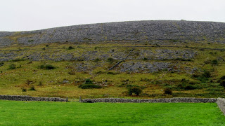
Further south, we drove through part of an area known as The Burren in County Clare, a portion of which has been designated a national park.  This is a very large plateau composed of barren limestone rock in unique striated patterns that used to be below sea level in ancient times.  The land was later thrust upward by some kind of massive geological event.  This was fascinating scenery unlike any I have seen before.


The Burren
Our next stop were the Cliffs of Moher, said to be Ireland’s most-visited natural attraction.  The cliffs are vertical limestone cliffs that plunge 500 to 700+ feet into the sea.  Although conditions were not the best today, the cliffs were spectacular!  It is understandable why the area has been used as a setting for movies and TV shows.  The wind was blowing very hard here—I estimated the gusts at 50-60 mph.  It was very hard to walk upright and Richard was even blown over by one gust!


The Cliffs of Moher
Richard and Essie at the Cliffs of Moher 

We continued our drive on down to the Dingle Peninsula, County Kerry, in southwestern Ireland where we stayed the night.  The landscape changed as we came south with larger fields and fewer rock walls and trimmed hedges around the fields.  More farming was in evidence and there were more trees.  Houses were also evolving into fewer of the tall, box-style, homes of the north country into more homes similar to those we see in the States.  We did not see as many sheep today as further north; however, we did see more dairy herds.

 Driving along a couple of country roads--and, yes, the speed limit is 50 mph!


I asked our hostess if this cold, wet, windy weather is normal for September.  She said it was not normal, that this is winter weather we are experiencing!  She went on to say the only difference between this week’s weather and the real winter weather is that it can get even windier with storms during the winter months.
FAST FACTS:  Ireland regularly leads the world in binge drinking.  Although efforts are being made to educate the populace, especially young folks, about the devastation caused by excessive alcohol use, drinking remains the country’s most popular social pastime with no signs of letting up.
Urbanization is breaking down traditional family/community interdependence that was prevalent during times of poverty in the country.  These traditional values can still be found in isolated rural communities and on islands.  The average number of children per family has fallen to 1.4, the lowest in Irish history.

Saturday, September 28, 2013

NORTHWESTERN AND WESTERN IRELAND


September 15, 2013
We woke up to wind and rain this morning—lots of both!

Mount Royd Country Home is known for its award-winning breakfasts and it didn’t disappoint.  The breakfast was something to behold!  I don’t remember the total number of fresh fruits carefully prepared by our hostess, Josephine, but it was at least a dozen.  I had smoked salmon for the entre.  After the VERY nice breakfast, we decided we just had to stay here another night!  (After-trip note:  The china used for meals at Mount Royd was the only china that was not white during the entire trip!)


Breakfast at Mount Royd
 
We drove north to a nearby ring fort named Grianan Ailligh that dates back to around the birth of Christ.  The walls are 4.5 meters thick and about 5 meters high with three terraces, or walkways, on the inside.  Two long passageways, which were blocked off, are contained inside the wall. The fort was the Royal Citadel for this area between the 5th and 12th centuries and was built on a high mound that may have been a sacred mound, or prehistoric burial place, possibly dating back to the Neolithic period (about 3000 B.C.)  Three small mounds, about which not much is known, circle the fort.  Speculation is that they may have been part of a smaller Bronze Age or Iron Age hillfort.  Essie and I decided to climb up to the top walkway for a view of the countryside.  The wind was blowing hard—I would estimate it at 50 mph plus—so we did not stay up there long.  Coming back down on the narrow, wet, stone steps was a challenge.


Grianan Ailligh Ring Fort
 
Inishowen Peninsula, County Donegal (Below)
 Thatched roof cottage with out-buildings 
 A "Good" Country Road (Speed Limit = 50 MPH)
Countryside-Inishowen Peninsula
 

We continued to drive north on the Inishowen Peninsula to Doagh Famine Village.  We toured the site which was restored by a man that had grown up in one of the thatched homes.  He had assembled a lot of very old tools and equipment and he had produced dioramas showing life during various periods of time.  His talk was spiced with political perspectives before, during, and since the famine of the 1840’s which were quite interesting to hear.  Some of the exhibits, as well as his talk, contained interesting comparisons between the Great Famine (1845-1850) and famine-stricken countries today.  We were all surprised at the number of common sayings which we take for granted that originated in Ireland.  He shared many here and we heard others throughout the trip.  This location is well off the beaten path, is very remote, and has a harsh environment.  We were glad our hosts recommended it to us.
Doagh Famine Village
Instead of driving another 20 minutes to the northeast to reach the northern-most point of Ireland, we turned southeastward and drove through the center of the peninsula passing a few thatched cottages, which are still in use, along the way.
The weather today was VERY windy with many passing rain showers.  Gale force winds were forecast and they were certainly present in some areas along our route.

FAST FACTS:  The current government is a coalition of the center-right Fine Gael and center-left Labour parties who rose out of the ashes of the devastating 2008 financial melt-down.  They are not able to institute their policies because of the €85 billion (Euro) bailout by the International Monetary Fund, the European Union, and the European Central Bank, which has to be repaid at what has been described as a prohibitively high interest rate.  As one writer said, in a few short years Ireland went from a poster-child of economic success to a terminal patient on financial life support.
Times are tough.  Unemployment is up, pay is down, and tourism (one of Ireland’s main sources of revenue) fell by approximately 30% between 2008 and 2011.  In spite of these adversities, the Irish have not taken to the streets, as has been done in Greece and elsewhere.

September 16, 2013
We were up early and headed south, driving through County Sligo to Galway in wind and rain most of the day.  The first sight we saw along Sligo’s north coast was Benbulben (also written Ben Bulben), a high plateau which was “home” to Nobel laureate poet and dramatist William Butler Yeats.  Much of his poetry is set in the area and he is buried at the churchyard in Drumcliff at the foot of the plateau.  It was a very pretty area.

Our only stop of the day was Carrowmore Megalithic Cemetery which is a Neolithic era monument.  This is Ireland’s largest megalithic cemetery (and one of the largest Stone Age cemeteries in Europe) with over 60 monuments/tombs, some of which are among the oldest in the country.  Most of the activity took place here between 3000 and 4000 B.C.; however, two monuments date from 5400 and 4600 B.C.  The monuments include stone circles, passage tombs, and dolmens (a prehistoric monument consisting of two or more upright stones supporting a horizontal stone slab) that are set in rolling countryside. Some burial tombs were large mounds with the large central tomb containing remains of seven people--the oldest was about 58 and the youngest about 7 years of age.  They were buried as skeletons, not cremated like in other similar tombs.  This particular tomb has a reconstructed cairn surrounding it now, giving visitors some insight into the materials and methods of construction used during the period. 
Below:   Carrowmore Megalithic Cemetery
Central Tomb 
 
 Satellite Burial Site
Entrance to the central tomb (above)
 Central Tomb gravesite inside the cairn
The wind was blowing so hard as we toured the cemetery that the rain drops felt like ice hitting my face.  We did not linger long at this location!

We spent the night in Galway, on the west coast, and it is a picturesque town.  I would love to spend more time in the city and surrounding area since we only skimmed the surface so to speak.  We didn’t have any luck getting into a B&B, so we stayed at the Galway Arms Inn located along a canal in the downtown area.  This suited me just fine because it meant we could park the car and I didn’t have to drive us to and from dinner!  We spent a leisurely evening strolling the streets, listening to some good music in a pub, and eating traditional Irish dishes for dinner.  All in all, it was a very nice evening with good friends in a nice city!
The night out in Galway


FAST FACT:  Irish (Gaeilge) is the official language of the country and all official documents, street and road signs, and official titles must be either in Irish or in both Irish and English.  The language is really only used in the rural areas of Counties Cork, Donegal, Galway, Kerry, and Mayo--which are mostly western and southwestern counties.