Sunday, September 2, 2012

NORTH TO ÅRE


WEDNESDAY, AUGUST 8, 2012--Åre
Gunnar, Mari-Anne, and I were up early and out the door at 0625 to meet a neighbor who drove us to the train station.  We caught the train to Stockholm Central Station, then transferred to a train that took us to Åre (pronounced Orrra) in northwest Sweden.  The total trip time was about 7.5 hours and it was a great way to travel to the north country.  Initially, we followed much the same route to Gävle that we had driven southbound from our trip to Dalarnas during my first week in Sweden.  From Gävle it was all new country to me.  The farther north we went, the more it changed from the urban, rolling farmlands of the south.  More houses were painted the traditional red color that the barns and other outbuildings have all over Sweden.
Swedish Farm
A few homes were painted yellow, which seems to be a “favorite other color” for homes in Sweden.  The farms were quite small by U.S. standards and were mixed with timber and some logging as we went north.  From Bolnäs, midway through our 300-mile trip north followed by another 50 miles in a westerly direction, we followed water in the form of lakes and rivers nearly the whole way.  In addition--the country became more and more rugged.  We couldn’t tell it on the train, but we were climbing as we went north.  It really was a beautiful trip through this part of the country!  Logging seemed to become “king” as we went north because we saw more and more evidence of it.  Sawmills, paper mills and piles of logs being loaded and unloaded were a common sight.  I also noticed quite a bit of “clear cutting” being done in the north country, so I guess that method of harvesting timber has come to Sweden, too.  Gunnar told me that logging has become quite mechanized resulting in a loss of jobs in the northland with people moving elsewhere to find work.
Oh, and I must mention our food on the trip.  Mari-Anne had brought along coffee and tea as well as snacks for a mid-morning snack.  Then, midway through the trip, Mari-Anne and Gunnar broke out the lunch--I am sure we had the best lunch on the whole train!  Complete with a tablecloth, no less!  It was delicious!
Lunch on the Train
We turned west at Östersund to traverse the final 50 miles to Åre along a river and a long narrow lake in the bottom of a narrow, forested valley.  Yes, it really made me feel like I was back in the mountains!  We arrived in Åre at 1425, picked up the rental car and some groceries, and headed to the condo that the gentleman/neighbor who provided us the ride to the station this morning was letting us use for our stay.  This is a beautiful location high up on the mountainside overlooking the valley with its lake running through it.  After dropping our bags and groceries off at the condominium, we drove into town and took a short walk around to stretch our legs a bit.
Åre
It is a charming town located in a major downhill skiing area, reminding me of some of the smaller ski resort towns in the Rocky Mountains.  One source lists Åre as the largest ski resort area in Sweden and in 2009, Condé Nast Traveller named it winner of “World’s top ski resorts”.  There are also quite a few long cross-country hiking trails up in this part of Sweden and I saw several backpackers in town.
We returned to the condo after checking out the town and surrounding area.  Gunnar and Mari-Anne prepared a wonderful dinner of boiled potatoes and a skillet casserole dish with reindeer meat, vegetables, onion, and cream.  They also served Lingonberry jam (a staple in Scandinavian cuisine)—just a little used with each bite of potato and the casserole.  Ice cream and a chocolate mint from the local chocolate factory finished off the meal. 
"Chef" Gunnar

Ready for dinner in Åre
After dinner, I helped Gunnar set up a geocaching account on his cell phone.  A lively and interesting discussion of world politics (one of several such discussions we had) topped off the evening.  This brought to end a long day filled with new sights and experiences.

FAST FACTS:  The elevation at Åre is approximately 4700MSL.  Snow was in the mountains not very high above town and the tree line appeared to be about 5000MSL.  Temperatures were definitely cooler than in the Stockholm area that is at or near sea level.  Åre is about halfway between 63°N and 64°N.
Very large parking lots for bicycles surround the train station in Uppsala.  I would estimate there were easily several thousand bikes left there for the day by commuters.  It seems nearly everyone rides a bike in Sweden; it is as normal as walking to your mailbox outside your house in the U.S.  In addition, people of all ages use this mode of transportation.  I didn’t see many motor scooters in either Norway or Sweden, but I did see quite a few motorcycles in Sweden (mostly Harley Davidsons).
 
Bicycle parking at Uppsala Train Station

THURSDAY, AUGUST 9, 2012—Åre
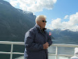
We had a leisurely breakfast before heading out to explore the Åre area.  Our first stop was Åreskutan Mountain (elevation 4656 ft. MSL) where we rode the tram most of the way up the mountain.  We were above tree line shortly after we ascended from the tram station and we went into clouds just before reaching the upper station that is located just below the mountain’s summit.  (Snowmobiles take skiers to the summit.)  Patches of snow were around the higher areas and the temperature was -2°C with a blustery wind blowing when we got off the tram.  This was quite a change from the 100°+ F temperatures I had left in South Dakota—and which they were still having!  We took the next tram back down the mountain and the skies were beginning to clear while we descended.  The weather was promising to be a beautiful day in the mountains.
Åreskutan Mountain


Looking west from Åre
We next drove to Tännforsen waterfall a few miles west of Åre.  Tännforsen is one of Sweden’s largest unspoiled waterfalls, formed on a steep edge of a jutting section of slate bedrock.  Special growing conditions exist here because of the near continuous existence of mist resulting in rare and interesting lichen on the slate rocks and trees around the falls.  I saw numerous types of lichen that were the largest I have ever seen and I had no idea of all the various types of lichen that grow here.  I am a lichen “watcher” when I hike because it is a good indicator of the air quality in an area; however, the varieties I saw in this area were really mindboggling!  The park’s observation platform at the falls really takes you “up close and personal” to the roaring falls—and did they roar!  There was no way that you could talk while on the platform because of the noise.  This part of Sweden, as with Norway, had an abundance of moisture this year so the falls were really putting on a show for us.

Above Tännforsen waterfall


Tännforsen waterfall
Before leaving Tännforsen, we decided to have lunch.  I had trout with a delicious dill sauce; we also had Swedish waffles with cloudberry jam for dessert.  The waffles are thin by U.S. standards and are very light and fluffy.  Cloudberries come from north of the Arctic Circle and the jam was very tasty.  It is quite sweet with small seeds in it similar to seeds found in raspberries.  All in all, this was a superb lunch!

Our final stop this day was at Njarka Sameläger (aka Njarka Sami Camp), a living open-air museum operated by a Sami woman and her husband.  We arrived in time for the 3 o’clock tour but, instead of staying for the normal one hour, we didn’t leave until 1745!  We were the only customers for the tour and since we seemed very interested in hearing what the woman had to say, she spent extra time explaining the Sami culture, political issues, lifestyle, etc., in addition to answering our myriad questions.  After giving us a very complete tour of the camp, including new huts under construction, she invited us into one of the teepee-style dwellings at the camp and gave us coffee prepared over an open fire to drink while she prepared bread for us.  The bread was cooked in a cast iron skillet and was good.  We sat on the ground on reindeer hides and listened to stories she told us of Sami life and of the struggles they are having in today’s political system.  She said she has encouraged her children to leave the Sami camp and get jobs elsewhere because their lives will be easier than if they live the traditional nomadic Sami lifestyle of raising reindeer.  They have lost much of their traditional grazing land over the years to large hotels moving in and buying up vast quantities of land for guests that come to hunt.  Other land has been bought up by different business and political entities with the end result being that reindeer herds have dwindled due to lack of grazing land availability.  She said that some Navajo Indians from the U.S. had been in the day before and their stories were very similar to what the Sami have experienced.  As we were talking, I was thinking of all the Native American villages and lands I have visited through the years, and the striking similarities between what the Sami are going through now and what the Native Americans have gone through.  The woman was very passionate and, as I told Mari-Anne, she really had that “fire in her belly” when it came to sharing her story with us.  All three of us came away with a much better understanding of the Sami culture and the problems they face today and beyond.  We talked about her many times that day and in the days that followed.  To say that she made an impression on us is an understatement!
Njarka Sami Camp


Sami "backpack"
 
Traditional Sami footware
 
Feeding reindeer

Coffee and conversation time in the Sami dwelling
Our Hostess making bread for us

Bread cooking over open fire (thanks for the pic, Mari-Anne)
FAST FACTS:  The Sami are indigenous to the Scandinavian Arctic with lands in Norway, Sweden, Finland, and the Kola Peninsula in Russia.  The region where they live is usually called Sápmi, but sometimes Samiland.  They have their own culture, language, traditions, and, since 1986, their own flag.  There are approximately 20,000 Sami in 51 communities in Sweden.
Reindeer play a key part in Sami culture providing them with food and leather.  The antlers are used to make knife handles and jewelry.  Not all Sami are reindeer farmers as commonly believed; historically, they have made a living from fishing and other activities.  Today, they are involved in tourism, clothes design, the media, and other professions similar to people outside their culture.
FRIDAY, AUGUST 10, 2012—Åre and back to Stockholm
We were up early and after breakfast, we cleaned the condo in preparation for our departure.  With these chores done, we headed out on a 7 mile round trip walk to a nearby copper mine named Fröȧ Gruva (English:  Fröȧ Mine) and associated buildings, including old homes, on the site.  Mining began here in the 1740’s and continued during four periods until 1919.  The site is now operated as an open-air museum and considerable restoration has been done to ensure visitors can see the unique pumping system operate at the mine.  I am not an engineer so won’t try to explain the pump system but suffice it to say that the horizontal cross-arms connected to the vertical poles in the photo swing back and forth moving the long arms extending between the vertical poles in a back-and-forth action which, in turn, drives large wheels.  It was a fascinating system to watch and I wish I could explain it better.  Oh, and there is an “Earthcache” at this location so I was able to introduce Gunnar and Mari-Anne to this type of geocache while they bagged their first earthcache “find”.  Soon it was time to hike back to the condo to gather up our belongings and head to the train station.
Fröȧ Gruva  hike

Fröȧ Gruva Maypole

Fröȧ Gruva home--don't remember date but built sometime in late 1700's/early 1800's

Portion of Fröȧ Gruva pump system (still operates)
Fröȧ Gruva waterwheel
The train left right on schedule in mid-afternoon; however, we were delayed getting into Stockholm because of railway signal problems in the Stockholm area.  We then caught the train from Stockholm to Jakobsberg where a son-in-law met us and drove us home, arriving there just before midnight.  Mari-Anne prepared coffee/tea and snacks, as well as a nice dinner complete with a tablecloth, again, for our return trip.  The food was very good and very much appreciated!

FAST FACTS:  I saw a lot of grass roofs in Norway and Sweden.  In Norway, new buildings (including holiday homes) constructed in areas with a lot of visitors, such as mountain resorts and/or ski areas, must conform to environmental standards; i.e. they must “blend in” to their surroundings.  Grass roofs are one means to accomplish this.  I don’t recall seeing many on newer buildings in cities and villages, most were on older buildings in those areas.  However, there were a lot of grass roofs in rural areas.  In Sweden, there is a move to have grass roofs on buildings (even in cities) because they are efficient and environmentally friendly.  Gunnar mentioned several newer large buildings right in their town that have grass roofs.  The roofs are an important element there in urban storm sewer planning since they significantly reduce the amount of water runoff, in addition to providing very good insulation from hot and cold temperatures, among other benefits.  Generally, these roofs have a lifespan of 2-3 times greater than a conventional roof.
I did not see any maypoles in Norway; however, they are very prevalent in Sweden where new ones are erected with lots of fanfare in mid-June when the hours of daylight are longest.

Wednesday, August 29, 2012

RAMBLING IN THE STOCKHOLM AREA

TUESDAY, AUGUST 7, 2012—Stockholm
Mari-Anne and I headed out for one of the premier areas to visit in the Stockholm area—Djurgården, which is an island close to the central city.  The island has been royal land since the 15th century and has a lot of green space, walking paths, museums, etc.  We had but part of a day to spend there, but I believe one could easily spend most of a week there!  Skansen, located on the island, is the world’s oldest open-air museum.  About 150 buildings from throughout Sweden have been moved here in an effort to depict how people lived and worked in the 19th and early 20th century—or earlier.  We went into “shops” such as a glass blowing shop, a furniture maker’s shop, grocery, hardware store, bakery, etc., where people (many in period dress) showed us how they made their products or showed off their wares that were for sale at the time.  The docents were always ready to explain what they were doing and answer our questions. 
Skansen Glass Blowing Shop
Some interesting farm buildings were located outside the “village” proper.  The photo shows a farm building from southern Sweden from the beginning of the 19th century.  The information sign stated that similar homes existed
 in Sweden from early Medieval times.  The central, low-ridged cottage was used for eating, sleeping and working.  To the left was a storehouse that was also used as sleeping quarters in the summer.  A weaving room was to the right of the central cottage.  The upper floors were used for storage. 

19th Century Farm Home
Another interesting exhibit were the two “allotment huts” that came from Stockholm’s southern island.  During World War I middle-class people were allotted small plots of land to use for growing vegetables to help alleviate the serious food shortages in the cities.  Small shelters were initially built on the plots to provide shelter from rain but these were later replaced by more elaborate huts.  
Alottment Hut
The Stockholm Zoo featuring animals found in Scandinavia was adjacent to the open-air museum and, since people were finishing their summer holidays, this area attracted a great many children.  The Seglora kyrka (Seglora Church) was erected in 1730 and moved to Skansen in 1916.  The walls are timbered and both the roof and the walls are lined with oak shingles on the outside.  The shingles are painted with a mixture of tar and traditional red paint.  The tower was built in the 1780’s.  Inside, the church is whitewashed and the barrel-vaulted ceiling was painted in 1735.  This is one of Sweden’s most popular churches for weddings.
Seglora Kyrka
We took a short stroll down a tree-covered path to a botanical garden that specialized in plants native to Sweden.  This was a large colorful garden and visitors were encouraged to pick flowers to take with them.  Mari-Anne, guide extraordinaire, knew of a place to eat in the garden and we enjoyed delicious sandwiches and tea under the shade of an umbrella.  
Botanical Garden on Djurgården
Following lunch, we took a bus and the subway back to downtown Stockholm.  Along the way we passed buildings with exclusive condos in central Stockholm that are priced at around $1 million USD or more for a small 1,000 square foot unit.  We walked around the central Stockholm shopping district and Mari-Anne pointed out several areas of interest that I would not have seen without her.  We also visited the Stockholm Concert Hall, a large blue neoclassical architectural-style building with gray columns at the front, which is home to the Royal Stockholm Philharmonic Orchestra.  It is also the location in Stockholm where the Nobel Prizes (except the Nobel Peace Prize) are awarded.  (The City Hall hosts the banquet for awardees.)  Close by was the City Conference Centre with a beautiful fountain in the plaza.  I decided this was the perfect fountain to have a picture taken nearby to complete the geocache challenge “Fountains of the World”. 


Mari-Anne and I by the City
Conference Centre Plaza
Fountain


Soon it was time to catch a bus and head southeast to meet Gunnar for dinner at Fåfängan, a quiet restaurant high on a hill with breathtaking views of Stockholm and the harbor.  The evening was beautiful, the company was wonderful, the food was very good, and we were constantly entertained by views of the city and the busy harbor with cruise ships coming and going, ferries sailing to and fro, and other smaller sea vessels moving along the waterways.  After dinner, we walked down the hillside to catch a bus, then the subway, and finally the train back to Jakobsberg.  It had been another long and wonderful day in Stockholm! 
Stockholm Harbor

Tuesday, August 28, 2012

BACK TO SWEDEN

MONDAY, AUGUST 6, 2012--Oslo to Stockholm


Oslo Railway Station Band
I was up early to complete packing, get breakfast, and walk to the central train station about a block from the hotel, where I arrived 2 hours before departure time.  A band began playing shortly after I arrived and we were given about a 45-minute concert by the "railway station band" in celebration of the opening of a tunnel.  The music was good and railway workers handed out free coffee while the band played.  I even knew most of the songs!  The tunnel opening meant the end of a long bus ride over part of the route to a destination town.  I decided against using the toilet before leaving the station since a charge was imposed for the use of it--and I had already exchanged my Norwegian money for Swedish money.  Should have checked this situation out before changing out my money.  Oh, well...Fortunately, a "free" toilet was on the train.  Our tour guide had warned us that some places charged for use of the "facility"; however, I only encountered it once on the actual tour. 
Train from Oslo

The train out of Oslo had two cars and was a fast electric train.  The route took us northeast before turning southeast towards Karlstad, Sweden.  We passed along wide quiet flowing rivers, long lakes, and a lot of farms with green oats and wheat as well as some potatoes in the fields.  We went past the typical red barns and white houses that we had seen enroute to Lillehammer a week ago, but there was more forested area as we approached the Norway/Sweden border.
  
Train from Karlstad

I changed trains in Karlstad (western Sweden) without a problem and got on a longer train that had nice cars.  It is sure easy to see why the Scandinavian people like to use their rail systems.  The trains I have seen so far are clean, fast, run on time, and are relatively cheap to ride.  People routinely bring their pets aboard for the ride—one car is dedicated to the pets.  In fact, I was impressed by how people take their dogs nearly everywhere it seems.
 
I was entertained on this leg of the trip by a young woman and her two daughters, ages 4 and 7, who sat with me.  The older girl wanted to show me her knowledge of English by counting to 10 and telling me the names of colors that she knew (quite a few).  She also drew piano keys on a paper and pretended to play a piano while singing “Twinkle, Twinkle, Little Star” in English.  The younger girl joined in singing the song in English and did a commendable job.  They were a very nice family and made the time pass rapidly.  Mari-Anne was at the Stockholm Central train station to meet me and we traveled on to Jakobsberg on the commuter train.  Travel time from Oslo to Stockholm Central was 5:40 and the cost was about $70 USD.  And, I got to see some more very pretty countryside!

Tuesday, August 21, 2012

NORWAY TOUR ENDS


SATURDAY, AUGUST 4, 2012 (Oslo, Norway)

We were up early for the Oslo (Population 1.4 million in the metro area) city tour with a local guide. The city was founded in 1,049 A.D. and was named Oslo at that time. In 1624, the whole city burned to the ground; however, a king resurrected it and renamed the city Christiania—the name it retained until 1925. Norway was controlled by Denmark and Sweden for several centuries until finally gaining its independence from Sweden in 1905. I was quite surprised to find that it has been an independent country for such a short time. A constitutional monarchy is the form of Norway’s government and the people are quite satisfied with it as evidenced by votes on the issue.

There is a lot of construction going on in downtown Oslo with major projects everywhere. The waterfront area, in particular, is the scene of a lot of redevelopment that is scheduled to continue until 2020. In 2008, a new opera house, costing $750 million USD, was opened and is the centerpiece of the waterfront. The structure is designed to look like a glacier floating in the waters off Oslo. We toured the city’s modern City Hall with its elegant reception rooms, a fantastic view of the harbor and surrounding islands, and large murals depicting Norway’s history in the large hall where the Nobel Peace Prize is awarded in December each year.
Oslo Harbor with City Hall Twin Towers in Background

Oslo Opera House
Oslo City Hall Great Room where Nobel Peace Prize is awarded
Oslo City Hall Mural (portion)
Oslo City Hall

Oslo City Hall Harbor View

We strolled through Frogner Park with sculptor Gustav Vigeland’s over 200 extraordinary bronze and concrete sculptures.  Vigeland was contracted to prepare and place sculptures in the park and he worked at this task for 40 years until he died.  He did all the decorative artwork in the park, including the gates, and it is truly an amazing place.  His work ranged from entwined lovers to thoughtful and calm elderly couples to a hotheaded boy caught in a bad mood--all of which are nude.

Frogner Park
We drove through numerous neighborhoods, several of which had buildings containing condominiums, which we were told, sell for $1 to $3 million USD.  Home ownership is important in Norway and we were told 80% of Norwegians own their homes.  Homes in Norway are expensive, and with average take-home pay approaching $40,000 USD per worker, I never did completely figure out how they afford to own their homes.  Most women work outside the home so a couple would likely have around $80,000 USD after taxes.  The government has generous tax incentives for home ownership and interest rates are about the same as in the U.S.  In addition, their health care and education through college are paid through their tax system.
$1-3 million USD condos
Oslo has to deal with street people, particularly from Romania, for the first time.  We were told that Eastern Europeans and Russians are leaving their countries in large numbers and traveling to cities in western and northern Europe.  In Oslo, the immigrants do not have jobs and crime rates involving them are rising quite rapidly.  We were warned about several areas to avoid around the downtown area if we decided to go exploring from the hotel.
We visited three museums featuring Norway’s long seafaring tradition in the afternoon.  The Viking Ship Museum with its ships and artifacts from the Viking era on display was particularly interesting to me.  Viking nobility was buried in their boats when they died along with possessions and everything that it was believed would be needed in the hereafter, including items such as jewels, furniture, servants, food, intricately carved carriages and sleighs, tapestries, etc.  The sleek dark longboats on display are the best preserved that have been found and are quite large.  In the case of one boat on display that belonged to a queen, the queen’s maid was killed and buried next to her.  All three boats in the museum were made of oak in the 9th century and were buried about the same time.  The boats had been buried in clay on beaches in the Oslofjord region and the clay served to hermetically seal and preserve the boats and their contents.  The boats and contents on display were very interesting to examine and provided insight into the Viking traditions and culture.
Viking Long Boat
Carriage found in Long Boat
We next visited the Polarship Fram Museum that featured the ship of the same name.  The ship was launched in 1892 and was the strongest one afloat at the time.  It carried several polar explorers, including Fridtjof Nansen, Roald Amundsen, and Otto Sverdrup on journeys to the North and South Pole regions as well as on other polar explorations.  We were able to explore the ship fully and the museum had excellent exhibits on polar exploration.
Fram Polarship
The final museum we visited was the Kon-Tiki Museum featuring Thor Heyerdahl’s “Kon-Tiki”, a balsa raft that he sailed from Peru to Polynesia in 1947.  A reed boat, the “Ra II” used by Heyerdahl to cross the Atlantic Ocean in 1970 is also on display.  The success of both trips in these boats seems even more amazing after looking at the boats!  However, Heyerdahl was able to show that people could travel long distances on water long ago.
"RA II"
"Kon-Tiki"
This concluded our fast tour of central and southern Norway.  The area really is a land of contrasts and immense beauty!
Fast Facts:  The Viking era lasted about 250 years from approximately 790 to 1040.  Vikings traveled widely to the Black Sea, throughout the Mediterranean, and to the British Isles, Iceland, Greenland, and the North American continent.  Although they were famous for plundering lands abroad, the fruit of their fighting served to raise the standard of living at home.  The Vikings are credited with bringing Christianity to their Homeland, which resulted in the demise of their way of living.
North Sea Oil profits have helped transform Norway from one of Europe’s poorest nations to one of Europe’s wealthiest nations.
SUNDAY, AUGUST 5, 2012
After a fast-paced two weeks (yes, it was two weeks ago today that I left Sioux Falls), I felt the need to slow down some today.  I took a walk around the downtown area after breakfast and picked up another geocache in the process--my last in Norway.  I also checked out the train station to get a feel for where to go in the morning when I get ready to leave.  The station is less than a block from the hotel (Clarion Hotel Royal Christiania) so is very convenient.  The rest of the day was spent working on the blog, repacking the bags, reading and relaxing.  It felt good not to be on a schedule!

Saturday, August 18, 2012

Telemark, Norway

FRIDAY, AUGUST 3, 2012 (Telemark to Oslo)

We were up early and headed to Rjukan, a town in a very steep and beautiful mountain gorge, for a tour of the Vemork power plant which was the world's largest when completed in 1911 with a capacity of 145,000 hp. The power plant is cast in concrete and clad with chiseled granite; it now serves as a museum. The hall where the turbines are situated is about 50’ high, very long (maybe 500’), and narrow. A hydrogen (fertilizer) factory was built in front of the station and the factory was taken over by the Germans in WWII to produce "heavy water". Heavy water had been discovered in 1933 in the U.S.A. and it is so named because .02% of water molecules are actually deuterium, an isotope that contains an extra neutron. Heavy water weighs 10% more than normal water, boils at 1.4° C higher and freezes at 4° C higher than normal water. These properties make heavy water able to stabilize nuclear fission reactions, thus making it invaluable in the production of the atomic bomb. All available stock of heavy water in the world (including that used by the U.S.) was produced at Rjukan.

Vemork Power Plant
 

Rjukan Valley
During the War, the Norwegian Resistance in concert with the Allies mounted a sabotage effort against the plant. Specially trained British saboteurs sent to assist the four Norwegian advance team members were killed when one glider and its tow plane crashed into a mountainside, while the other glider crashed on landing and survivors were shot by Germans. The four Norwegians waited during a cold winter on the Hardanger Plateau for more assistance. Another group of British saboteurs was sent but they parachuted into a blizzard on Hardanger Plateau and had a long march to their intended landing site. Eventually, all met up and made the trek to the plant after descending the very steep mountainside and crossing a steep narrow gorge in front of the plant. The team was successful in largely destroying the plant the night of February 27-28, 1943. They skied back to Hardangervidda after which some went to neutral Sweden, with the rest staying and evading capture on the Plateau. The plant was quickly rebuilt by the Germans; however, after a bombing raid by 140 U.S. planes on November 16, 1943, during which 20 Norwegians were killed, the Germans decided they could not continue producing heavy water in Norway. A decision was made to move the heavy water by rail cars on a ferry to Germany. However, the Norwegian saboteurs got wind of the plan and planted a time bomb on the ferry, which blew up in the middle of Lake Tinnsjø, sinking in 1420’ of water. This effectively ended Germany's ability to produce the atom bomb before the U.S. did. After leaving Vemork, we drove through the village of Rjukan and along Lake Tinnsjø where we saw a “sister” ferry to the one that was blown up and the area of the lake where the ferry sank in 1944.
We continued our drive towards Oslo, stopping to see the Heddal Stave Church (Heddal Stavkyrkje), the largest of Norway's remaining medieval wooden churches. It is believed the church dates from 1242, but parts of the chancel date from 1147. The church was heavily restored in the 1950’s and is truly a beautiful structure. The walls had “rose” paintings dating from 1668 and a “Bishop’s Chair” dating from the 17th century was placed near the alter which dates from 1667. Those of you who have seen the stave church replica near Rapid City, SD and believe it is large, think much bigger to get the perspective of the Heddal church.
NOTE:  After the trip, I learned that my great, great grandparents on my Grandmother Rayburn's side were married in the Heddal church in the early 1800's.

Heddal Stavkyrkje

Heddal Stavkyrkje


The countryside changed quite a lot the past two days as we left the rugged mountains with their gushing waterfalls and high meadows to lower hills that are more rolling and many lakes. We began seeing more tillable farmland, large barns, and, as we drew closer to the coast once again, more people.
Telemark to Oslo
The day ended in Oslo with a drive up mount Holmenkollen to see the large modern ski jump and for dinner at a restaurant with a panoramic view of Oslo and Oslofjord.  The restaurant has dedicated itself to remembering the assistance given by Sweden to the Norwegians during WWII—a nice gesture, I thought.
 During the ride to the restaurant, our guide shared a bit of her favorite Norwegian drink called “Linne Aquavit” with us at a pull-off with a beautiful view of Oslo. It was “okay” but certainly not my “drink” of choice. The tour is definitely beginning to come to a close.
Our Guide--Adelheid Smitt
  FAST FACTS: You can camp wherever you want in Scandinavian countries because they have the “law of public accessibility”. You can hike on a farmer’s land but not through, for instance, the middle of a wheat field or other areas where a farmer’s crop would be damaged or destroyed. It is legal to camp on a farm without “permission”, but you cannot be in sight of the home. Because of these laws, they do not have “No Trespassing” signs in Scandinavia.
Municipalities have to provide homeschooling to children age six and under in Norway. School is free through university level and stipends are provided for transportation and books. Students have the same teacher in grades one through seven and English classes begin when children are age 10. (In Sweden, children have the same teacher in grades one through three and they change to another teacher for grades four through six.) They must go to school to age 16 and homeschooling is quite common in smaller communities.