August 1 Roberta and I went to the Alaskan Islands and Ocean Visitor Center in Homer. The center had very interesting exhibits and videos of birds and animals found in the Alaska Maritime Nat’l Wildlife Refuge which extends from the Arctic Ocean to the southeast panhandle. It protects breeding habitat for seabirds, marine mammals, and other wildlife on over 2500 islands, spires, rocks, and coastal headlands. This seems like a daunting task to me when I think about the weather and climatic conditions, plus the political influences they have to deal with. The center does a good job describing how human activity including the fur trade, WWII, post-war nuclear testing, and introduction of foxes and rats on the islands since the early 1700’s has upset the natural balance of nature resulting in extinction or near-extinction for many species. From the center, we went to Capt. Patti’s for lunch. This place had been recommended by the Aikin’s and it was good!
I took photos of the “Eagle Lady’s” home in our campground in the afternoon. She is 82 years old and has lived in the same location for 30 years. I didn’t get to see her, but looking at her garden is encouraged. It is truly beautiful with all the flowers in her small yard surrounding the park model style home. She is known for feeding 200-300 bald eagles approximately 500 lbs. of fish each morning during the winter. She has been doing this since shortly after her arrival on Homer Spit in 1977. Although her practice is somewhat controversial, she has become a fixture in the local culture. For more information Google “Eagle Lady, Homer, Alaska”. I especially enjoyed the videos on the Fogonazos: “The Eagle Lady” link.
It was time to leave the beautiful Homer area and August 2nd was our departure date. As with other places we especially enjoyed, Roberta and I decided to stay longer than we had originally planned. While I was pulling out of the parking lot in the morning, a bald eagle flew overhead and landed on the beach in front of me as though giving me a farewell salute. What a beautiful sight they are! Our destination was Seward on the southeast side of the Kenai Peninsula. I saw one black bear come out of the woods, look at me, and head right back into the woods while driving the Sterling Highway. There is a lot of evidence of spruce bark beetle activity on the peninsula as well as in other areas of Alaska. Dead trees are a very common sight as you drive through the countryside. We drove through light rain much of the way and parked in Seward’s City Campground. This is another wonderful spot right on the water. They really have their act together in this town when it comes to accommodating campers!

August 3 we checked out the town’s visitor center for maps and ideas, and then had lunch at Ray’s Waterfront Restaurant. Thanks again Aikins for another great suggestion! (Roberta says we are going to have to start sending them the bills because they have certainly steered us the right way to the good eating places along the way!) The afternoon was spent at the Alaska SeaLife Center

which was very well done and time well

spent. I especially enjoyed watching the underwater views of sea lions, seals, and diving birds in the large tanks. And the puffins were wonderful to watch as they scurried across the top of the water and dived underwater. They are amazing birds!

Seward is a very pretty area with mountains rising up right from the water’s edge. It is a temperate rain forest so there is a lot of vegetation. They also get a lot of snow here in the winter. Population is about 3,000 and the town’s economy relies on tourism, shipping, and fishing. Holland American Cruise Line ships come in three times a week. I watched one back out of its dock and turn around right in front of our campground this evening. It is quite a maneuver they do here to depart the harbor.
August 4th I did some shopping around town and spent over 4 hours uploading a blog posting. The library, where I found a good WIFI connection, closed before I was able to finish the post.
August 5th Roberta and I went to see Exit Glacier north of town. The glacier is within Kenai Fjords Nat’l Park and the road to it is the only road in the park. I joined a ranger-led hike up to the terminus of the glacier and enjoyed being able to get up close and personal to a glacier. I took a walk along the waterfront at the campground after dinner where I watched a sea otter for about 40 minutes as it floated along in front of the campground. It was just lazing along enjoying a beautiful evening, as was I.
Monday, August 6th, was going to be laundry day. They have one coin-op laundry in town and when I saw that the cheapest washing machines cost $4.00 per load and drying cost $.25 for 4 minutes it didn’t take long to decide I would do one load of necessaries instead of the planned 3 loads of laundry. When the laundry was done, I finished uploading to the blog while I could use the library’s excellent WIFI. Roberta and I went to the library again in the afternoon to see movies about the 1964 Good Friday Earthquake. The quake did a lot of damage in town; however, the tsunamis that kept sweeping through during the night really devastated the town. Silver salmon arrived here and they were jumping all over the bay late this day. What a sight! Some looked like they were dancing on their tails while others just jumped up and then dived back into the water. Sunrise in Seward today was at 5:50 a.m. and sunset was at 10:16 p.m. The days are definitely getting shorter.


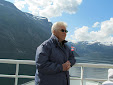
August 7th dawned with the sun shining and we boarded a tour boat for a cruise into Kenai Fjords National Park. What an incredibly beautiful trip this was! The park, located on the southern Kenai

Peninsula, has 32 glaciers flowing out of the Harding Icefield which is the largest icefield contained wholly in the U.S. The icefield is several thousand feet deep in places and receives over 900 inches of snow annually. We watched the Aialik Glacier, which is estimated to move 2 to 5 feet per day, calve numerous times while anchored. We also saw a lot of wildlife including humpback and orca whales, sea otters, Stellar sea lions, harbor seals, silver salmon jumping in the water, a mountain goat, both horned and tufted puffins, kittiwakes, several types of gulls common murres, cormorants, and bald eagles. Near the end of the trip we were treated to a bountiful salmon bake on Fox Island in Resurrection Bay.


We were back on the road the next day for the drive in to Anchorage. Enroute we stopped to take the Alyeska Resort tram ride up Mt. Alyeska. We had lunch at the top and watched paragliders take off from the mountain and land in the valley below. Girdwood was destroyed by the 1964 earthquake but has rebuilt about three miles inland from Turnagain Arm. As I drove along Turnagain Arm I noticed that the fire weed blossoms are gone which is a local sign that winter is but six weeks away. We boondocked in a Fred Meyer store’s parking lot during our two nights in Anchorage where we restocked supplies, did laundry, etc. The last evening Tom and Kristie Gummer invited us over for a delicious grilled salmon dinner. It was fun visiting with them and I look forward to seeing them again next year.
August 10th we drove a whopping 45 miles to Palmer in the Mat-Su Valley where we found a wonderful campground at Matanuska River Park, a city park. We didn’t find this campground in a camping guide—I found it in a “Moon” guidebook which called it “one of the most luxurious city campgrounds in Alaska” and is it ever! Sites were grassy like in a front yard in the Outside with flower gardens in the center island. We visited the local visitor center and spent the remainder of the 10th and the 11th exploring the Palmer and Mat-Su area. The 11th we drove over Hatcher Pass coming out at Willow. This was a sunny day to drive in the mountains and we saw more wild, desolate, but beautiful country. The foliage was just beginning to show some fall color. We were joined by Betty Springen and Joyce Logan, both RVers from Anchorage, for dinner and good-byes. We may have an opportunity to see one or both of them this winter on the Outside.


We drove to Valdez, AK, which is located on Prince William Sound on August 12th. It was a beautiful drive that began in light rain. I was thinking as I was driving that I haven’t seen many songbirds up here. There are some in Alaska, but not in the numbers you see in the Lower 48. We saw the Matanuska and Worthington Glaciers (both are large) enroute as well as some of the higher peaks in the Wrangell-St. Elias Nat’l Park. I hit a bird at my eye level in the left windshield north of Valdez—didn’t have any cracks show, but they probably will. Shortly after that a black bear came out of the bushes to my left and raced me down the road a bit before going back into the brush. Upon arrival in Valdez we met up with the Booths and the Morrisons who are guiding a WIT Tours caravan through AK. One of the couples on their trip had been to one of my ABQ Balloon Fiesta rallies and we all had a good visit.
Monday, August 13, dawned sunny (always a bonus on these seaside towns, I think) and after bidding the folks on the WIT caravan good-by, Roberta and I moved to waterfront sites at the Bear Paw adult campground. These were great sites and we could watch all kinds of boats


coming and going. I went fishing with Gil and Sandy Glover in the afternoon and we had a wonderful time visiting and catching silver salmon that were running in Prince William Sound. We ended the afternoon with eight salmon in the cooler—not a bad afternoon’s work. Gil and I used to work long distance while we were employed by the FAA—he was in the Fairbanks FSDO and I was heading up the FSIRP program out of Albuquerque. He told me over five years ago before I retired that he would take me fishing when I got to Alaska--and we finally did it, didn’t we Gil? He has just retired and he and Sandy will likely have a lot more time to enjoy the water now. It was a great afternoon and will truly be one of the highlights of this Alaskan adventure for me! I hope we can cross paths next winter when they come down to the Lower 48.
The 14th through the 17th consisted of washing both the RV and the car which were filthy, working around the RV, relaxing, and sightseeing around the Valdez area. It is a quieter town than Homer and Seward which suited me perfectly. I could see nine or ten glaciers from the campground and, again, the mountains rose up directly from Prince William Sound. We enjoyed the location so much we decided to stay an extra day. Weather was rainy and cloudy much of the time, but the location was beautiful no matter what the weather. We visited the local museum which told about the area’s history as well as how the town was devastated by the 1964 earthquake. Old Valdez suffered a lot of damage from the earthquake whose epicenter was 45 miles away. The town was flooded and over 30 lives were lost, but it did not suffer the devastating tsunamis that Seward experienced.
Valdez was re-established on donated land 4 miles to the west when it was rebuilt and the area is called the “Switzerland of America” by one guidebook. If you like “wet”, this is the place to come! Annual snowfall in town is over 300 inches and Thompson Pass, about 35 miles north, records 600 to 900 inches annually. Rainfall in Valdez averages 64 inches and their record sun was in 2004 when they recorded 33 days above 70 degrees. However, their winter average temperature is 22.5 degrees and Valdez has the furthest north, year around, ice-free port in the U.S. This is why their port was chosen for the terminus of the 799 mile Alaska Pipeline.
One of the many boats we saw was a fuel barge that was parked at a dock in front of our campground for a couple of days. I asked what they were loading and was told they were taking on diesel fuel which would be hauled to various communities along Prince William Sound. Roads don’t exist beyond Valdez and the outlying villages use generators for electricity. The fuel would be used to power the generators.
We left Valdez on Saturday, August 18th, headed north. Our journey back to the Lower 48 really began this date since the remainder of our travels will be north, then southeast through Yukon Territory, and south through central British Columbia. We saw more interesting country on the 18th and beyond; however, that will have to wait for a later post.
 August 21st saw us on the road again as we departed Destruction Bay for Whitehorse, Yukon Territory. We continued our drive along Kluane Lake and Kluane National Park. Wild, wonderful, beautiful, country! The day was clear so we had good views of the ice fields in Kluane N. P. Towards the southwest corner of Kluane Lake we drove on a portion of the original Alaska Highway which
 will likely be closed at the end of this construction season since the road is being re-routed at that location. We had been told that this stretch is the last of the original Alcan that is still in use, so we were among the last to drive on the original roadbed as part of the Alaska Highway route. The foliage was definitely turning to the fall colors as we drove southward on the 20th and 21st.
 August 22nd was spent in Whitehorse doing odd jobs around the rig, but we took time off to visit Miles Canyon. This was an area of the Yukon River that presented some serious challenges to the Klondike Gold Rush men and women traveling through here.
 assigned to her tour in the afternoon. We went up the White Pass & Yukon Route (WP&YR) railroad to the top of White Pass. This route was scouted as a longer, but less steep, trail for the Klondike Gold Rush to serve as an alternative to the steeper, but shorter, Chilkoot Trail. The first engine went into service over the first four miles of
  track in July 1898, two months after construction of the railway began. Builders of the railroad faced immense challenges which were recognized in 1994 when the WP&YR was designated an International Historic Civil Engineering Landmark—one of only 36 civil engineering landmarks in the world to receive this
  designation. The trip on the railroad was very interesting, not only from the perspective of the engineering involved in climbing 3,000 feet in 20 miles, but the scenery we saw as we snaked along the canyon walls was beautiful. Nancy met the tour group at the top and drove us back to Skagway providing a running narrative of the sites and history along the way. Thanks, Nancy, for a great ride!
 Skagway is a cruise ship town—5 were there when we arrived. The town is full of tourists and the WP&YR even takes its trains across the city streets and down to the various docks to pick up and drop off the cruise passengers. The town has 33 jewelry stores, and is getting two more next year! “Moes”, reportedly the oldest saloon in AK, is closing this year and will be one of the new
 jewelry stores next year. We thought we would get a drink in this historic watering hole but it was so noisy that we went down the street. Other than a bunch of T-shirt shops and other tourist traps, plus a few eating places and unique buildings, the town didn’t show me much. Too many people!!! The National Park Service does have an interesting Visitor Center and interpretive tour of the historical district.
 We stayed overnight in Skagway returning to Whitehorse on the 24th. On the way we stopped in Carcross which played a large role in the late 1890s and early 1900s. We also stopped at the Carcross Desert which is billed as the world’s smallest desert and, in fact, is an International Biophysical Programme site for ecological studies. The sand dunes do not cover much area and lie between 2 kilometer markers on the highway.

 mud, road each way. The scenery was beautiful
 as we drove over and around mountains, through a First Nation village along a river, along the Grand Canyon of the Stikine River, and up and down grades as steep as 20%. We were treated to great views of a lynx that stood on a bank alongside the road long enough for me to get some quick pictures. A rainbow greeted us as we neared camp in the
  evening. The car—well that is another
  story! It was absolutely covered with mud—you couldn’t get in or out without getting mud on your clothes. I pressure washed it when I returned to camp; however, as I was to find out later, I didn’t get all the mud off and out of it. Telegraph Creek was formerly the head of navigation on the Stikine
  River and an
  estimated 5,000 stampeders set off from there to attempt the Stikine-Teslin Trail to the goldfields in Atlin and the Klondike. Although rigorous, the drive to Telegraph Creek was as beautiful as the native of British Columbia who recommended it to me at a campground in AK had said it would be.


