Saturday, August 4, 2007

JULY 1-20, 2007--DENALI, TALKEETNA & ANCHORAGE

July 1 we moved over to River View RV Park so we could have power and water the last few days in Fairbanks. I went to the aviation museum at Pioneer Park and found it to be interesting. They had several wrecked aircraft from around AK that had been retrieved over the years and they had the metal crosses that were placed at the Wiley Post/Will Rogers crash site about a year after the crash near Barrow. The crosses were later moved and donated to the museum.

The next day Roberta and I drove down to Nenana, a shipping port on the Tanana River about 57 miles south of Fairbanks. Nenana means “Camping Spot at Two Rivers” in Athabascan and the town is situated at the confluence of the Tanana and the Nenana Rivers. Freight and supplies, such as propane bottles for people in bush towns along the Tanana and Yukon Rivers, are shipped by barge since there are no roads west of here. The town has seen larger populations, as many as 5,000 people at one point, during the construction of the Alaska Railroad, construction of the Parks Highway between Anchorage and Fairbanks, and during WWII. Population now is about 370 and most are of Athabascan descent. The town has kept its Athabascan heritage which is quite evident.

Nenana is well known throughout Alaska for the annual Ice Classic which has become “Alaska’s Biggest Guessing Game”. Tens of thousands of Alaskans and Outsiders place $2.50 bets on the day, hour, and minute of the ice breakup on the Tanana River. The pot is over $270,000 which is 50% of the gross. A four-legged tripod is set up on the river ice in February with a cable running to a clock tower on shore. When the ice moves, the clocks stops and the official time is recorded.

We met a woman who moved to Nenana from Milwaukee in 1970 and who has become a local spearhead in the town, owning several businesses. In fact, as we went around town, it became evident she owned most of the businesses catering to tourists including the main restaurant named Two Choice Café. The rumor is that you have two choices there “take it or leave it”. Actually, the food wasn’t bad for a bush café.

We went across the Tanana River to the town’s Native cemetery located on a tree-covered high hillside overlooking the town and the river. White wooden crosses marked graves, some of which also had stone markers similar to those used in the Outside. Many graves had picket fences surrounding them, others were outlined with logs. There didn’t seem to be a lot of rhyme or reason to the location of the graves as they were scattered on the hillside--some in rows, others weren’t. There were a lot of folks that died at young ages (under 35), including quite a few children.

July 3rd we drove to the Healy area and parked at the Denali RV Park and Motel—a nice park at the base of the mountains about 8 miles north of the entrance to Denali National Park. I had serious engine overheating problems on the long 38 mile uphill climb out of Fairbanks. This situation had been frustrating me on much of the trip and seemed to be a continuation of problems experienced last year on the East Coast and in the Rocky Mountains. I thought I had it solved by people in ABQ, but evidently not.

We spent the 3rd, 4th, and 5th getting oriented to the Healy/Denali area, driving some backroads and the single 15 mile long road you are allowed to take into Denali Park. We saw several cow moose, some with calves, in this area and many arctic hares which are larger than rabbits I was used to seeing in the Lower 48. We also got the rigs ready to receive our Mothers who would arrive the end of the week.

I should mention a little about permafrost up here. It is of a discontinuous nature south of the Brooks Range—it is present in some areas and not in others. For instance, it is present on the north slope of the ridgeline on the north side of Fairbanks, but is not present on the south slope. That seems to be a pattern in a lot of interior Alaska.
Fish Lake
July 6th Roberta and I drove to the Talkeetna area where we had reservations at the Paradise Lodge for two nights. We didn’t exactly know what we would be getting into, but we really lucked out! The lodge was relatively new (less than 5 years old) and on a beautiful setting overlooking Fish Lake south of Talkeetna. The managers were from New Zealand and very personable. They even moved us to a newly built lodge for the next night when our Mothers would be with us so the Mothers wouldn’t have to climb
the steep steps in the main lodge. We were the first to stay in the new quarters and were charged the same rate for those quarters as we would be charged in the main lodge, which was $400 under the regular rental rate of $600 per night! The latter quarters had a living room, sitting room, 3 bedrooms w/ 3 baths, decks all around so you could see the views, and a large kitchen. Wow! What a way to introduce the Mothers to Alaska! And Roberta and I didn’t mind it a bit either!

We drove to Anchorage on the 7th where we had breakfast with a friend of Roberta’s and her friend—both RVers. Then on to the airport to pick up our Mothers who arrived within about 15 minutes of each other. We had lunch at the Sourdough Mining Company (good) before heading up the road to Talkeetna and Paradise Lodge where we enjoyed getting acquainted over cheese, crackers, wine and wonderful scenery. Everyone was very tired so the party didn’t last long that night!

The Mothers and the Daughters at Paradise Lodge

We were up early on the 8th to drive to Healy where we had to reposition our RVs to new sites as soon as we arrived. (This has happened more than once in AK as RV parks juggle their spaces to accommodate caravans and people like us that are passing through.) The Mothers settled in and we took them on the 15 mile drive into Denali National Park after dinner. And we finally saw a caribou in the wild near the Savage River! We had been seeing warning signs about caribou since arriving in Canada; however, this was our first sighting. What a rack it had!

Left: Finally a Caribou in the wild!

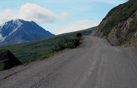
Right: Denali N.P. Country


This Wild Country Called Denali!


Left: Gizzly Bear

Right: The Park Road


"The Mountain"

Mt. McKinley aka Denali

(Rt. photo taken about 1 hr. after the left photo and 20 mi. closer)


Caribou and the Park Road

Denali N.P.


Monday, July 9th, Mom and I were on the phone early to family in SD to find out how everyone was fairing in the Hot Springs area with the fire outside of town. My niece had to evacuate her horses to a safe location, but the fire did not extend into the town or to the location where she boards her horses. Several others were not as fortunate. Midday Roberta, her Mother, my Mother, and I boarded a shuttle bus for a 6-hour tour back into Denali N.P. The scenery was incredible and we saw 6 caribou, 4 dall sheep, many arctic hare, and a grizzly bear. The large animals were all a large distance from the road so it was hard to get good photos even with the telephoto lens.

The next day Mom and I took the 8-hour shuttle tour back into the Fish Creek area—a 63 mile trip each way. It was a wonderful trip seeing the wild countryside and we were fortunate to see Mt. McKinley several times as the clouds parted. Some notes I took from the driver/guide’s comments:
--They have 8 months of winter in Denali.
--Tree line is at approximately 2700’ MSL.
--“Taiga” describes the lower forested areas. It is a Russian word meaning “little sticks”.
--There are 2 kinds of tundra: wet and dry. A brush line usually separates them.
--Road construction work in the park begins at 10 p.m. and goes all night during the daylight when buses aren’t running. (We saw some daytime; i.e. 8 a.m.-5 p.m., repairs being made because of mudslides caused by yesterday’s rains.)
--17 of the 20 highest peaks in the U.S. are in AK.
--The highest highway pass in AK is between 4800 and 4900 feet. (I didn’t get the exact altitude.)
We saw 6 dall sheep, 9 caribou, many arctic hare, 1 falcon, 1 hoary marmot, and 1 grizzly (seen twice) on the trip. Again, the larger animals were in the distance which made getting good pictures tough. I did get some decent shots of Mt. McKinley, though. It had been a long day, but we saw a lot of wild, wonderful country!

July 11th and 12th were spent in the Healy and Denali areas where we did local sightseeing, shopped for souvenirs, went through the Park’s Visitor Center and watched a dog sled demonstration. Dog sleds are still used by Park Rangers to patrol the back country in the winter where they are on the lookout for poachers, people in trouble, etc. These are extended trips lasting several days at a time. Mom and I took a short hike in the Park on the 12th and we saw a red fox in the silver phase a couple of times in the community of Denali. It was headed south at first, then back north with a hare in its mouth. Dinner for the pups? I learned later that a sighting of a silver or black phase red fox is quite rare; however, this one obviously lives in the area. I managed to come down with a flu-like bug in the early afternoon, so that was the end of my Denali area touring. Roberta took the Mothers on a drive in the afternoon to a backcountry overlook we had found which had beautiful views of Healy, the Nenana River, and south into the Denali area. They saw four moose during the drive which was a highlight for Mom.

We drove to Talkeetna on Friday, the 13th and set up at Talkeetna Camper Park—a neat camp ground right in town. I was still feeling lousy and running a fever, so spent the afternoon in bed. Roberta showed the Mothers around the town which is really an interesting, quaint little town. It has a back country feel to it that is really charming. The next day we all took in the Moose Dropping Festival which is THE BIG EVENT of the year. It was fun, complete with a parade, craft exhibits and entertainment in the park, and plenty of opportunity to people watch. We also saw a program about Don Sheldon (deceased) who really started the glacier landing business in Alaska. I’d heard about him for many years in the 1960’s and 70’s and enjoyed seeing the movie about him and his flying. We took the Mothers to Latitude 62 for dinner in the evening—a place we found the night before we picked them up in Anchorage. They serve good halibut in season.

TALKEETNA

Left to Right:
Carol & Betty
Roberta & Evelyn


The next morning I was up early and drove to the airport to see the planes used for glacier flights. I was particularly impressed with K-2 Aviation’s setup which was very clean and professional looking. I might mention that Talkeetna eats, breathes, and lives for “The Mountain”; i.e. Mt. McKinley. The National Park Service has a ranger station there and they station rangers up on the mountain (I think it was at the 14,000 foot level) during the climbing season. The vast majority, if not all, climbers use Talkeetna as their staging area and the local aviation operators fly the climbers and their gear up on the mountain. The success rate for reaching the top generally runs around 50%. I’ve never gotten into mountain climbing, but it has always fascinated me. I watch programs and movies about expeditions at every opportunity, so it was fun to experience the local ambiance surrounding The Mountain—even though the climbing season had drawn to a close a few days before we arrived.

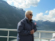
After we had a hearty breakfast, complete with a tremendous crowd of locals and visitors at the Talkeetna Roadhouse, we drove to Anchorage. The Roadhouse is a quaint historic building in town—one of those places you have to visit when you are there. (The cinnamon rolls weren’t as good as the ones at Tetsa River Lodge.) We got set up in Anchorage and a fellow employee from the company I flew for in Missoula, MT, in the late 1960’s and early 1970’s, Tom Gummer and his daughter Gracie, came out to visit us. We made plans for a flight in the area the next day. I hadn’t seen Tom since our company reunion in Missoula four years ago, so it was really great to connect once again.

Tom Gummer
Monday, July 16th, was a day that I will never forget! Mom and I were up early to meet Tom for his “glacier flight”—and what a trip it was! Tom has a Cessna 185 on floats based at Lake Hood, the busiest seaplane base in the world. As we were preparing to climb aboard, a bull moose showed up on an island next to the waterway we would be using to taxi for takeoff. It stayed as we taxied by—totally unconcerned. We took off and went southeast along Turnagain Arm, then turned northeast over Girdwood and up
over the Chugach Mountains where we saw numerous glaciers. Our destination was the foot of a glacier that emptied into Lake George. The lake was a beautiful turquoise with ice floes scattered in it. We landed in clear water adjacent to and parallel to the glacier and parked there several minutes just to take in the beauty and serenity of the place. I could have stayed all day and not gotten tired of seeing the immense beauty surrounding me. However, we had to depart and Tom had some more beauty in store for us as we flew low down “The Gorge” which was a narrow canyon between Lake George and the Knik Glacier. We continued on alongside the front of the Knik Glacier before turning west. What a trip and what scenery! We flew on to a lake near Wasilla, landed, and had a cup of coffee at a picturesque resort before flying back to Lake Hood. Tom’s wife, Kristie, and daughter Gracie were awaiting our arrival and we all had an enjoyable lunch. Now for the confession. I “never” run out of battery power for my digital camera; however, my battery gave out as we were on final approach into Lake George so I don’t have any photos from while we were parked there by the glacier, from the flight down The Gorge, or in front of the Knik Glacier. I am still kicking myself about that snafu—thought I had a spare in the backpack, but it wasn’t there. That flight, though, will always be the highlight of this trip!


Left: Bull Moose on Lake Hood

Right: Chugach Mountains

east of Anchorage


Left: Glaciers in Chugach Mtns.
Right: Lake George. Note "The Gorge" along the mountain going from the lake back to the foot of the Knik Glacier in upper portion of photo.


Left,Right, and Below:
Lake George


The next day, July 17th, was another day for seeing glaciers because Roberta and I had made reservations for a glacier cruise in Prince William Sound complete with an all-you-can-eat salmon and prime rib buffet. We drove along Turnagain Arm to the one lane tunnel that is shared between trains and motor vehicles—each mode of transportation goes one-way at a time on a set schedule. Whittier is at the other side of the mountain (tunnel) and is where we sailed out of for the cruise on Blackstone Bay. We were about six hours on the cruise and saw several glaciers, including Blackstone Glacier which calved several times while we there. We also saw numerous kayakers, bald eagles, sea otters and waterfalls. We went with Major Marine Tours which has won awards for their shipboard cuisine and it was good. The cruise was enjoyable and seas were calm, so it was a good day. Then it was back to Whittier, through the tunnel (had to wait for a train to go through first) and back to Anchorage. A side note: Whittier was nearly destroyed by the 1964 earthquake as were many towns in south central Alaska. Approximately 80% of the town’s residents (town population is 300) live in one building that looks like an older apartment building but is reported in a guidebook to be condos. The mountains rise up rapidly from the waterfront here and they can get 14 feet of snow during winter. Other than some seaport activity, including glacier tours, we couldn’t find much to do in Whittier. We even had trouble finding a cup of coffee along the dock area while waiting to board the boat!

GLACIER CRUISE OUT OF WHITTIER, AK

Sea Otters

Blackstone Glacier (Calving in right photo)


Now here is some "cool" ice!


The 18th was a “down” day as we regrouped from yesterday’s activities. Mom and I went to Earthquake Park which commemorates the 1964 Good Friday Earthquake and walked around there. We then went downtown to The Anchorage Museum of History and Art before taking a walk to look at the beautiful flowers along the streets, on buildings, etc. We didn’t get through much of the museum—that is definitely a place I would like to spend more time in on a future trip. The afternoon was spent organizing and packing Mom’s belongings for her return to SD.

All too soon, it was time to bid the Mothers good-bye as they flew back to the Lower 48 on July 19th—Roberta’s mother to Sacramento, CA, and my Mother to Sioux Falls, SD. It had been a fun 12 days having them up here and they got to experience and see a lot of what Alaska is all about. We had to move to different sites within the campground this date, so we got that done after seeing our Mothers off and spent the remainder of the day working around the rigs.

Friday, July 20th, I was up early to drive to the Caterpillar dealer to see if they could determine what was causing the overheating issues I’d been having. They couldn’t tell much except that, yes, I’d had a problem. Roberta and I went over to the Alaska Native Heritage Center in the afternoon. This is an interesting facility where we saw native boys performing games that are done in the villages, artisans at work, and an interesting museum. Outside the central facility they have created five different areas showing the types of buildings used in traditional villages by the five principal native cultures in the state. This proved to be an interesting visit and well worth the time spent and the admission price.

Sunday, July 22, 2007

JUNE 22-30, 2007--FAIRBANKS, AK

Sign along the Dalton Highway: "Truckers--The Kings of The Kamikaze Trail"
"Sure it gets a little rough at sixty below. Your brakes freeze to the drums, or you can pop a drive shaft like a piece of candy cane if you're not kind of tender with the gears. Make a wrong move on a hill, and suddenly you're driving an eighteen-wheel toboggan. That's how come some guys call this road the Kamikaze Trail. But it's the best trucking in the world if you know what you're doing."


June 22 in the Fairbanks area was a catch-up day around the rig finalizing some plans for the Anchorage stay, getting mail downtown, etc. (The USPO in Fairbanks said it could take 2 weeks for a Priority Mail package to get here from Sioux Falls, SD—it took 9 days!) We enjoyed a noontime concert by the 9th U.S. Army’s jazz band in the downtown park and continued the sport of “people watching” in the far north. Both the band and the people were very entertaining. We looked around downtown and went into the Ice Museum which turned out to be an $11 rip-off. Roberta and I both definitely agreed it wasn’t worth the price of admission! We finished the day by going to the Alaska Salmon Bake at Pioneer Park. Now, that was a good choice! Kind of pricey, but worth every dime.

We were up very early (3:45 a.m.) on June 23rd to get to the airport where we boarded a bus at 0500 for a trip up the Dalton Highway, aka “The Haul Road”. We initially traveled several miles on other highways before getting on the Dalton Highway north of town. The Haul Road was built to service Prudhoe Bay and the Alaska Oil Pipeline which, by the way, is 30 years old this year. It is a slow road—gravel with some short stretches of pavement where it has been re-routed. The drive was very interesting with vast expanses of uninhabited land. We saw miles and miles of areas where forest fires had burned in past years similar to those we had seen in other far north areas.

The U.S. DOT requires that re-routed stretches of the highway be paved which is pretty ridiculous up here. The locals would rather keep it gravel because the permafrost doesn’t cause frost heaves and subsequent breakup on a gravel road like it does on a paved road, therefore giving a smoother ride overall. What heaves there are on a gravel road can be graded and that is the end of the maintenance. Paved roads are much more complicated and expensive to maintain in the far north.

On the drive north we paralleled the pipeline most of the way and saw a lot of black spruce, hillsides covered with pink fireweed, tundra, bedrock that had been “floated” to the surface by the freezing and thawing of permafrost, and many small lakes in the boggy tundra. At one point we stopped to walk on the tundra—it was very “squishy” and much like walking on a sponge. Our guide dug down about 10” into the tundra to the permafrost. She wrung a surprising amount of water out of the soil that she dug up. We were able to reach down and touch the permafrost which felt like touching a block of ice.

Our guide had chocolate cake along to celebrate crossing the Arctic Circle on a balmy day where the obligatory photos were taken. We then continued north into the Brooks Range foothills and along the southeastern boundary of the Gates of the Arctic National Park to the destination at Coldfoot. Roberta and I had signed up to fly from Coldfoot to a native village at Anaktuvuk Pass deep in the Brooks Range; however, poor weather prevented us from making that portion of the trip. What a disappointment! (We had also tried to book a trip to Barrow and Prudhoe Bay, but these were sold out weeks before. I will definitely return for this trip in the future!!!) Since we couldn’t fly further north, we flew with other bus passengers back to Fairbanks in a Piper Chieftain.

Although the Dalton Highway is 400+ miles long, there are only two small parcels of privately-owned land along it. In fact, only ½ of 1% of land in Alaska is privately owned. The guide also told us that only 2% of tourists go anywhere north of Fairbanks, including the small communities just outside the city, and 80% of them never leave the “cruise ship corridor” which has Anchorage as its northern terminus. Our trip north of the Arctic Circle put us in the small minority of Alaskan visitors indeed. It was a long, but very interesting day and I look forward to seeing that part of the North Country again.

June 24-27 we worked around the rigs, saw local sights and I worked on uploading my blog which was getting to be very time-consuming because the posts would not upload. One evening we went to the Malamute Saloon in Ester, a restored gold mining town just west of Fairbanks. They had an entertaining musical show telling the gold rush story in song and verse. We also took in the Tanana Valley Farmers Market where we found the vegetables and fruit to be quite expensive and much of it was imported. Crafts at the market were quite pricey, also.

June 28th we moved to Pioneer Park in Fairbanks where we boondocked for several days. The city won’t let RVs park at WalMart in town, but the borough (i.e. county) will take your $12/night to boondock in the parking lot at Pioneer Park which is located in the city. The park features restored buildings that have been moved from other parts of the city and small businesses operate from them now. Had dinner at the Pump House where I ordered steamed clams for the first time on the trip. Uuum! Good!

The next day we went to the University of Alaska Fairbanks’ Museum of the North. It is a very well done museum covering all areas of the state. The building housing the museum was completed in 2005 and is an outstanding contribution to Fairbanks’ north side skyline. The downside of the museum is that instead of using appropriate temperature controls inside display cases to preserve exhibits, they keep the whole building at a very chilly 69 degrees or below. I was really cold dressed in shorts and a t-shirt--and I wasn’t the only one. Even men were walking around with arms folded, huddled up against the chilly conditions! All in all, though, the museum is a wonderful stop in the city.

June 30th we bought groceries, got haircuts, etc. in the a.m. before going to the University’s Large Animal Research Farm in the afternoon. They study musk ox and reindeer at the farm. Incidentally, reindeer are a genetic subspecies of caribou and are basically domesticated caribou. The musk ox were particularly interesting to me with their shaggy hair. There are an estimated 3,000 musk ox north of the Brooks Range in AK and an estimated 160,000 worldwide in the circum-polar regions. I don’t remember the estimated number of caribou in AK; however, one herd is estimated at 500,000 and the worldwide population is estimated to be 6-7 million. All in all, this was a very interesting stop and I would recommend it highly to anyone visiting Fairbanks.


We ended up staying in the Fairbanks area several days longer than I thought we would. It is very interesting and I left things to do on a future visit. Who knows, I may even consider a trip back in their “forty-below time” of year to see the northern lights! A Japanese airline runs daily flights there in the winter bringing folks to see the aurora borealis.

Saturday, June 30, 2007

JUNE 10-21, 2007: YUKON TERRITORY AND ALASKA


June 10th found us driving 273 miles from Watson Lake to Whitehorse, Yukon Territory. It was a 12-hour trip due to some planned stops along the way as well as road conditions slowing us down when we hit the intermittent stretches of gravel and frost heaves. When on gravel stretches that had not been wetted down by rain, the visibility was virtually zero from the dust as trucks passed. Fortunately, we didn’t have many encounters. Signs were posted saying “Extreme Dust” in these areas—we believed them after the first one! We also found that most bridges were marked for two-way traffic; however, when driving a wide-body RV, they are basically a one-lane bridge in most cases. You could (and I did) pass a small car going the other direction, but it was tight. Fortunately, there wasn’t much traffic so we both just took the center out of the road since no one was coming the other way. Once in awhile, we would just wait until a truck got through before we started across.

We drove along Teslin Lake (78 miles long and 2 miles wide) awhile before stopping at Teslin, YT, to visit a museum and wildlife exhibit. Both were very interesting—we learned a lot about the times before the building of the Alaska Highway, the Tlinget Indians, gold mining, and the Royal Canadian Mounted Police at the George Johnston Museum and Heritage Park. Many diseases were brought into the area with the building of the highway and subsequent trade/business along the way. At one point, 128 of the 135 residents of Teslin were sick with measles, meningitis, etc., resulting in numerous deaths. This was a story we were to hear many more times in the Yukon and in Alaska as white men moved into the areas. The wildlife exhibit at the nearby Yukon Motel was very informative about birds and wildlife in the area. Our next stop was at Mukluk Annies for a salmon dinner—it was good. We crossed the Yukon River for the first time about 15 miles east of Whitehorse. It is wide and pretty this far inland. We parked at Pioneer RV Park in Whitehorse—it is wall-to-wall RVs, all headed to Alaska. I went outside a few minutes after 11 p.m. to take a picture of the RVs and to enjoy the daylight. It is still very light at that hour here and I just had to record it! I am still getting Sirius satellite radio along this part of the route; however, I lost my DISH TV service shortly after crossing the border in Alberta.

We stayed in Whitehorse June 11th and 12th. What an interesting town! We toured several museums and buildings; however, the most noteworthy (I thought) were the MacBride Museum, the Yukon Transportation Museum, and the Yukon Beringia Interpretive Centre. The latter was particularly interesting since it focused on the landscape, flora, and fauna of the last ice age. Eastern Siberia, Alaska, and Yukon were untouched by glaciers while the rest of Canada was covered by ice. Sea levels dropped over 300 feet and grassy tundra appeared that supported amazing varieties of animal and plant life. This is called the lost sub-continent of Beringia and North America’s earliest human inhabitants moved in from western Beringia at least 24,000 years ago. The center has a wonderful collection of life-size exhibits of animals such as a full-size cast of the largest woolly mammoth ever recovered. Its use of computer simulation to present the story of Beringia is outstanding.

We went to the Frantic Follies vaudeville show which celebrates the Klondike Gold Rush. This was a good choice since both Roberta and I really enjoyed the show. We also enjoyed seeing sights around town such as the Yukon Assembly building, the Log Skyscraper (3 story high single-room apartments), the Old Log Church, and the historical SS Klondike—the largest vessel to work on the Yukon River. A real “find” was the Yukon Artists at Work Coop south of town. We spent quite a lot of time there admiring the work and talking with artists present.

Yukon Territory’s population is just over 31,000 and about 23,000 of them call Whitehorse home. The city provides free parking to tourists passing through for three days which is nice. The town has a real small town feel to it. What struck us both was how friendly the people are and how very proud they are of their Yukon. It was nice to see their spirit.

All too soon, it was time to leave Whitehorse, but we know we will be back later on this trip and we have a list of things yet to do in that area. June 13th found us on the road to Destruction Bay, YT. This was a short day because we know the next leg will be a long day. About 40 miles west of Whitehorse I saw the largest cow elk I’ve ever seen. We also saw our first Dall Sheep at Sheep Mountain near Kluane Lake. I counted 17 head of them up high on the mountain. Many blue and magenta wildflowers adorned the roadsides which made for a beautiful drive through some very rugged countryside. The mountains were obscured much of the way by clouds and rain; however, the drive really reminded me of New Zealand’s South Island countryside.

We arrived in Destruction Bay (population 40) just before noon and had a delicious lunch at the lodge where we were camped. I spent 4 hours washing the rig using extremely cold water piped up from below the permafrost layer. I knew it would get dirty again the next day, but I needed to get some of the layers of mud off the coach and the car. The Destruction Bay Lodge and RV Park has only had water turned on for a couple of weeks this year. They wait until the ice (6 feet thick this year) is out of Kluane Lake before turning on their water. The permafrost at this location begins about 4 feet below the surface and extends down 130-140 feet. Their well goes down 150 feet. This is a very pretty location; however, we have really noticed the mosquitoes for the first time on the trip. Temperatures since we arrived in the Yukon have been in the mid-forties at night and up to the high sixties during the day.

June 14th found us departing early for Tok, Alaska. We knew from talking to various visitor center personnel, truckers, and other RVers that this would be the most difficult leg of the Alaska Highway because of the frost heaves, stretches of gravel, and areas of road construction. We were hearing stories of 10-12 hours for the trip. It was indeed slow—it took us 9 hours for the 231 mile drive. However, we both felt the stretch wasn’t quite as bad as promised—you just gotta slow down!!! Most of the drive was at 30-40 mph and occasionally we were driving 25 mph. The posted speed limit was 50 mph—only the truckers were doing that and they even had to slow down sometimes. By the way, I am getting good at watching for squiggly white lines marking the road edges and the yellow lane divider. I didn’t learn to watch for them while growing up in SD where we dealt with frost heaves every spring—you just remembered where the heaves were. However, when you are up here driving unfamiliar roads with heaves all along the way, the squiggly line stripes are a primary way of seeing rough roadway ahead. That is, if there are any pavement markings at all!

We made a brief stop at Buckshot Betty’s to try her cinnamon rolls; however, they were not as good as others we have had along the way. This is a small roadside restaurant and Betty was quite the character. So far, the cinnamon rolls at Tetsa River Services still take the prize for the best rolls and they will be hard to beat! That place is up for sale—I hope the family’s recipes are part of any sale deal for the benefit of future travelers.

After clearing customs and taking the requisite pictures entering Alaska, we parked the rigs at Tok, AK. This town is about 90 miles inside AK and caters to people on the Alaska Highway since it is the first major “entry” town. There are more RV sites and motel rooms than residents.
We left the rigs in Tok and took my car over the Taylor Highway to Chicken, AK, and on to the Top of the World Highway to Dawson City, Yukon Territory. This was a two-day trip into some of the most remote and beautiful country on the continent. The Taylor Highway was paved but had quite a few frost heaves. Chicken is a delightful little settlement about 75 miles from Tok. It has a few businesses, 3 of which are owned by a woman, an RV park and associated business, and a wonderful small log post office. Gold mining has been in the community’s past history but it now serves as a destination for RVs going between Tok and Dawson City or a stopping point for cars going the same route.

We continued on to the Top of the World (TOW) Highway which runs for about 110 miles over mountain ridges past Boundary, AK, across the US/Canadian border, and on to Dawson City, AK, returning on the same route the next day. We had read and heard all kinds of stories about the TOW Hwy which is why we decided to park the rigs and take the toad. What we found was a mostly-gravel road which was a slow go, but only had one stretch that was very narrow with no shoulder on the cliff side. It would be a very long fall if you were to go off the road there! While driving the road, we both agreed taking the toad was the best way to do the road since we were driving 10-15 miles faster than we would have driven the rigs and that one really narrow area, just over a mile long, would have been a “challenge” if you met someone in it. Someone would have had to back up because it is not wide enough to pass. Additionally, I paid $5.60 Canadian per US gallon for regular fuel in Dawson City which was also a good reason to take the car instead of the rig.

The TOW Hwy drive itself was an incredible experience and I would not have wanted to miss it. There are miles and miles in every direction of unspoiled, uninhabited wilderness, much of it above timberline. You really get a sense of how BIG the land is up here—a sense that I can’t find adequate words to convey and pictures won’t do it justice. I just felt surrounded by the incredible immensity of the land. What an experience! It is truly a drive that no one going to Alaska should miss.

Dawson City was a very interesting town and we found the people there very proud of their heritage as well as their land. A free ferry transports people and vehicles across the Yukon River to/from the TOW Hwy and Dawson. The city is clean and codes keep it looking like the historical town it is--right down to the board sidewalks.

We saw old buildings left on the main street to show the effects of permafrost. The buildings are sagging badly and will eventually fall. Some newer buildings are put on blocks with multiple jacks that can be adjusted as the building shifts from the effects of permafrost melting. Shims are added or taken out after the jacks are adjusted to stabilize the particular part of the building affected. The adjustments are made when doors don’t open properly, etc. Another construction technique involves digging a large hole into the permafrost and putting rocks/gravel in it, sometimes topped with a layer of insulation to try to keep the permafrost from melting. Open-air spaces are frequently left under new buildings in an attempt to keep heat from the building from going down to melt the permafrost below.


We saw some local sights such as Robert Service’s cabin, the Jack London Centre, and Diamond Tooth Gerties show at the Gambling Hall. The latter was a disappointment since it is really hyped. The show in Whitehorse was much better. We drove up Bonanza Creek to see the “Discovery Claim” as well as Dredge No. 4 which was a very impressive structure. The valley has mine tailings throughout and claims are still being worked using Caterpillars and hydraulic mining procedures.

Locals in the North Country have told us that the seasons of the year are divided as follows: June is spring, July is summer, August is fall, and the rest of the year is winter. Others divide seasons into two—“construction season” and winter. They also divide these long days into hours of “sunlight” when the sun is up and hours of “daylight” when the sun has set. Therefore, in Tok, AK, on June 16th, we have 20 ½ hours of “sunlight” and 3 ½ hours of “daylight”. It is light outside 24 hours/day now.

A note about the folks in northern BC and, especially, in the Yukon. Roberta and I have frequently talked about how proud the people are of their communities, their heritage, and their land in these areas. It just oozes from them whether you are talking to someone in a visitor center, a waiter or waitress in an eating establishment, a campground owner, or someone on the street. I am in Alaska as I write this posting—we don’t have the same feeling here. So far, after several days in the 49th state, it’s like being in the lower 48 in that respect. Maybe this will change as we go further around the state.

June 17 and 18 were spent in Tok looking around town and doing errands such as laundry, washing the RV and car, etc. The vehicles were filthy after the drive from Destruction Bay. We wanted to catch the favorable weather for the TOW Hwy drive when we arrived at Tok, so delayed the vehicle cleanup until after our return from Dawson City.

June 19th found us on the road to Fairbanks. We stopped enroute at Milepost 1422 in Delta Junction—the western end of the Alaska Highway. We did it—we drove the Alaska Highway! What a trip! We took the requisite pictures and got (make that we bought) a certificate stating
we made the journey. (This is one difference between the
theU.S. and Canadian cities—in Canada one doesn’t pay for certificates along the way. I think they are truly glad to have you pass through their area. We haven’t felt that way since crossing back into the U.S.) We pressed on to Rika’s Roadhouse for a good lunch and a nice walk around the grounds of the state park along the Tanana River where we had our first view of the Alaska Oil Pipeline. Our arrival at the campground just east of Fairbanks was just after 5:30 p.m.—4026 miles from ABQ.

The next day we went to the Santa Claus House in North Pole, AK, a few miles from our campground. It was full of tourists and is really quite a draw. We then went into Fairbanks to the visitor center, get some groceries, and in general begin to get the lay of the town. It was a quiet day, all in all, which was needed after some of the long days we had on the road.

June 21st—the day of the Summer Solstice is a very big deal up here. We began the day with a 3½ hour cruise on the sternwheeler Discovery III. This exceeded our expectations, I believe, because not only was it a nice trip on the river to see local homes, but they had a couple of demonstrations using float and tundra tire equipped Super Cubs, a stop at Susan Butcher’s home to see a sled dog demonstration (Susan, of Iditarod Race fame, passed away last August of leukemia), and a stop at a “native village” exhibit where interesting presentations were made. We ventured downtown in late afternoon to join the festivities at the city’s biggest event of the year—the Midnight Sun Festival. Several blocks were cordoned off for exhibitors, food vendors, attractions for kids, musical performances, etc. The event runs from noon to midnight every June 21. At 10:30 p.m. on this date each year, a local minor league baseball team begins a league game which is played in its entirety without artificial lighting. We spent a lot of the time “people-watching” while at the festival and saw a lot of tattoos, body piercing, Mohawk haircuts, and clean-cut folks from the local military bases. Although we didn’t stay in town until midnight, I was still up at midnight at home. Sunrise in Fairbanks this day was at 2:57 a.m. and sunset was at 47 minutes after midnight for about 21 hours and 50 minutes of sunlight and 2 hours 10 minutes of daylight if I did my math correctly. It was neat to be this far north on this special day!

Wednesday, June 13, 2007

June 5-9,2007: NORTH ON THE ALASKA HIGHWAY

Roberta and I spent June 5th sightseeing around Dawson Creek, BC. I especially enjoyed the museum in the old railroad station as well as the nearby art gallery. The museum had a movie about the construction of the Alaska Highway which certainly gave us a better appreciation of the road we will be driving on for the next 1500 miles! The road was “built” ("roughed out" would probably be more accurate) in 8 months during 1942-43; however, it has been shortened (straightened) and reconstructed over the years since. We walked around downtown Dawson Creek and took pictures at Milepost “0” as well as other signs around town relating to the highway. There are many murals of historic Dawson Creek painted on buildings downtown—all were very well done and gave one a feeling of what it must have been like. The town is obviously proud of its history and heritage.

The following day we drove to Fort Nelson, BC. Trees have become noticeably shorter and we drove past the first black spruce we had seen. These trees are quite small with small branches and are very hardy survivors. We didn’t see any wildlife on the 282 mile drive which, for us, is quite unusual. Fort Nelson is quite small and its major industries are gas exploration and drilling, lumber, and traffic/tourists on the Alaska Highway. They like their fuel here—I paid $4.80 Canadian for the equivalent of a US gallon of diesel fuel. This was the highest price I’ve seen so far on the trip. Roberta and I had already decided to slow to 55 mph earlier today to conserve fuel and have more time to observe the countryside. Good decision!!!

June 7th marked one month on the road for Roberta and me. By the end of the day we had driven 2990 miles in the RVs and several hundred more miles in each of our tow cars sightseeing. On the drive to Muncho Lake, BC, we tested more cinnamon rolls—we’ve been running “taste tests” along the way—and found the best ones yet at a remote stop called the Tetsa River Services & Camp Ground. Their rolls were really good!!! We also stopped at the Toad River Lodge and left hats to be hung—another tradition along the Highway. (Mine is number 7141.) They have hats from all over hanging from ceilings, walls, etc., in several rooms and hallways. Two bear and five stone sheep were spotted on the drive. This was our first spotting of stone sheep.

We arrived early in a Provincial Park campground at Muncho Lake and found a perfect spot for the two of us to park in. Spent the afternoon enjoying the view of the mountains and the lake; however, the fee collector came around at 8:30 p.m. and said we couldn’t camp there. It seems that in Canada a sign with a tent on it and a red line through the tent doesn’t mean “no tents”—it means no camping! This was a day-use picnic site—but was also a perfect “pull-through” for our RVs. Oh, well, live and learn. We moved to “overflow” and parked next to the trash receptacle.

Sign at each end of Fort Nelson, BC: “ALL THOSE WHO HATE SPEEDING TICKETS—RAISE YOUR RIGHT FOOT”

June 8th we drove about 35 miles to Liard Hot Springs Provincial Park—a short drive to an obligatory stop along the Highway. The spring water was the hottest I’ve been in, but it sure felt good! I ran into a couple from ABQ that are in the same WIT (Winnebago-Itasca Travelers) club I belong to, Ski and Mary Kozloski. We had a nice visit and I am sure our paths will cross again on the trip. We are like a “wave” of RVs heading north and we recognize RVs from campgrounds and stops along the way as we all move north.


The next day found us on the road to Watson Lake and it was good wildlife viewing along the way with 5 bear, 3 mule deer, 3 bison, and 1 red fox spotted. We left the rugged Canadian Rockies and drove into more rolling, forested country. Rivers were running bank full and over the bank in some places from snow runoff and recent rains. We crossed into Yukon Territory outside of Watson Lake. The afternoon was spent walking through the famous Sign Post Forest where we hung the sign my brother, Steve, made for us. Roberta also hung one of her old California license plates for her tow car (toad). The tradition of placing a sign in the “forest” began in 1942 during construction of the Highway and by 1990 there were 10,000 signs. Over 61,000 signs are in the forest now! The city maintains the site—they know a good thing when they have it. I went to the airport to see the last remaining hanger from the WWII era “staging route” used to ferry planes from Great Falls, MT, to Alaska and later to Russia under the Lend Lease program. There is an interesting display at the airport relating events along the route during those years and I was pleased to see that the contributions of WASPS were noted. The evening was spent at the Northern Lights Centre where excellent films on deep space exploration and the aurora borealis were shown--both were well done and very interesting.
Roberta & Carol at the Sign Post Forest, Watson Lake, YT


Tuesday, June 5, 2007

June 1-4: Jasper to Dawson Creek, BC

We drove from Banff N.P. to Jasper N.P. via the Icefields Parkway. Roberta and I communicate by radio as we drive and we both agreed on this leg that we needed sunroofs in the motorhomes to see all the spectacular scenery around and above us. During the drive we encountered some bighorn sheep and, on one occasion, a bighorn climbed up on a hillside next to the road where a mountain goat was standing on top. That was quite a sight! We also saw our first bear on the trip. I thought for sure we would see some in Yellowstone or Glacier N.P., but we didn’t. I passed the 2,000 mile point since leaving Albuquerque just west of Banff village. Arriving near Jasper village, we parked at Whistler Campground in the N.P.—another nice park with pull-throughs, nice trees, and elk roaming through on occasion. After setting up camp and relaxing a bit, we drove to Maligne Lake. Enroute we passed Medicine Lake which disappears each winter, only to reappear in the spring. Maligne Lake is the largest natural high altitude lake in the Canadian Rockies and is truly a beautiful location. The upthrust mountains alongside the lake are really incredible to see. During the drive we saw 29 bighorn sheep along the highway just north of Jasper village and two moose and one bald eagle off the main road. The eagle was high up in a tree preening itself and totally unconcerned about the group of us watching from the ground.

June 2nd we drove to the Columbia Icefield Centre to take a tour onto the Athabasca Glacier. We were bused to the loading point for the Ice Explorer vehicles which are unique to say the least. The ice was estimated to be approximately 1000 feet thick where we were let out to walk on the glacier. The Columbia Icefield is 120 square miles in size and is the largest body of ice in the Rocky Mountains. Drainage from the icefield goes to the Pacific, Arctic, and Atlantic Oceans. It was an educational and very interesting experience. On the drive back to camp, we stopped at the Sunwapta Falls and the Athabasca Falls—both were unique and had a lot of water flowing because of the snow melt. We also saw several bighorn sheep and 13 mountain goats by the road on the return trip.

While driving the Icefields Parkway that morning I asked Roberta how one could describe the fantastic scenery we were seeing. She replied that you can’t describe it—you just have to say it is incredible. That pretty well sums it up.
Sunday, June 3rd, we moved to a KOA at Hinton, BC. This was planned as a “down day” for shopping, laundry, catching up on email (the park has WIFI), etc. The park was quite new and very nice. Vegetation is quite a bit behind this far north. Peonies have just put out buds and I saw a few lilacs just beginning to bloom in Jasper village. Wildlife count this day: 2 elk, 1 muskrat.

We drove to Dawson Creek, BC, on the 4th. It was a 299 mile drive through some hills and rolling countryside. We had several 8% grades between Hinton and Grande Prairie on Highway 40. The road was generally good with steep shoulders (i.e. no shoulders to pull over onto). Vegetation in that portion of the drive was of a sub-alpine nature; trees were short and without long branches, probably due to the short growing season and severe winters. The countryside opened up just south of Grande Prairie and was rolling with farms interspersed with groves of trees the rest of the way to Dawson Creek. Quite a lot of grain is raised in this area and we saw cattle and elk being fed. We stopped at the South Peace Centennial Museum at Beaverlodge, AB. This is an agricultural pioneer museum featuring buildings that have been moved onsite and refurbished with early to mid-1900’s furnishings, an antique car/pickup/truck collection, many antique tractors and threshing machines, many artifacts, etc. It was a very interesting stop. They offer free overnight parking to RVers (no hook-ups) who visit—it would be a good stop in the future. It was hot today—87 degrees was the warmest I saw on the thermometer as I was driving. We are finally at the beginning of the Alaska (Alcan) Highway and I’ve driven just over 2500 miles from ABQ.

Monday, June 4, 2007

MAY 27-31: Calgary and Banff National Park

Sunday, the 27th, we crossed into Canada at approximately 0915. The border crossing went smoothly and we drove on to Calgary. The plan was to stay at a Passport America campground; however, to make a long story short, that place was a disaster and we headed for the nearest WalMart parking lot. This wasn’t exactly how I’d planned to spend my first night in Canada, but it worked! We found another campground the next morning and moved to it. The rest of the day was spent exploring and getting acquainted with Calgary. We decided to move on the following day (May 29) which we did after washing the RVs and meeting a gentleman who is an RVing single for breakfast. Roberta had corresponded with him online and he provided some helpful information as we were headed north.

The drive to Banff N.P. was indescribable with lush green fields, lots of wildflowers (including LOTS of dandelions), and spectacular views of the Front Range of the Canadian Rockies! The upthrust was really impressive with the knife-edge tops. After getting into the mountains, the views were absolutely fantastic. Snow pack is still 50% above normal for this time of year so we are getting to see snow-covered peaks. Very pretty! We parked at Tunnel Mountain Trailer Court right outside Banff. It has nice pull-throughs and deer roam through frequently. Columbia ground squirrels are all over the place and really make a lot of racket—but they sure do entertain Zia! What a day!!!

The next day (May 30) was fabulous! (I will probably be using this description frequently. Ha!) We were up early to drive the Bow Parkway to the Lake Louise gondola. The ride on the gondola was beautiful with spectacular views from the top. We decided we didn’t have time to do the Columbia Ice Field today so drove west of Lake Louise to the “Spiral Tunnels” just over the border in British Columbia. It is hard to describe the scene, but imagine a train snaking its way up or down the side of a mountain, going through tunnels, and on three elevations of the mountain simultaneously. We saw, perhaps, the longest train I have ever observed do exactly this. Roberta talked about this sight for several days afterwards—and it really is an incredible sight. Thank you Bob and Gene Nora Jessen for this wonderful recommendation. I will put a photo in of the view; however, it won’t do the scene justice. You may want to enlarge it so you can see the closest level.

We next drove to Lake Moraine in the Valley of Ten Peaks near Lake Louise village. This lake was featured on the back of Canada’s $20 bill at one time and it truly is a beautiful location. This area of Canada was under water 500+ years ago before the Rockies were formed—part of the Pacific Ocean which stretched well east of Calgary—so a lot of sea life fossils have been found here. From Lake Moraine we drove to the Fairmont Chateau Lake Louise hotel on Lake Louise. It was crowded around the lake with tourists already; however, this is really a beautiful location and we decided we must return in the morning. We hurried back to camp to change clothes and drive on to Cranmore for the “Oh Canada Eh?” dinner show. This production was very entertaining with Canadian “color” and featured a good cast as well as a good dinner served family style. I think we were at one of 2 or 3 large tables that weren’t a tour group, but we struck up interesting conversations with folks from England and Ontario. After the show we arrived back at Banff about 10 p.m. and, since it wasn’t yet dark, we decided to drive to Lake Minnewanka before returning to camp. We saw some bighorn sheep, elk, and deer on that drive. The highlight of the drive, however, was to watch the moon rise above Two Jack Lake—the nearly-full moon reflecting on the water coupled with the last sun rays on the mountains ahead and to our right was a spectacular view.


May 31 found us up early and driving to Lake Louise. We arrived before the horde of tourists and were greeted with beautiful reflections of the surrounding mountains in the lake’s water. There was still some ice on the lake which cut into the photo opportunities; however, it was a quiet, peaceful, beautiful scene just the same. Before leaving, we walked around the hotel’s grounds and through the lobby area—it is a beautiful hotel in a beautiful location. We next drove the Bow Parkway to Johnston Canyon where we walked on catwalks much of the way up to the lower falls. It was a beautiful walk to the falls which drop about 100’. The gorge below is approximately 3’ wide at one point, so the water really rushes through there. We then went to downtown Banff and walked around there while getting our daily (?) ice cream fix—well almost daily.

We have not been impressed with the Canadian drivers to date. They drive fast and seem to be quite rude; however, the people we have dealt with have been very friendly. We have been very surprised at the large number of rental RVs on the road—Class B’s and C’s. I would estimate that over 50% of the RVs parked at Tunnel Mountain C.G. are rentals.

Sunday, June 3, 2007

MAY 13-26: WYOMING & MONTANA

May13-19

We left Loveland for Lander, WY, on the 13th. It was a good drive except the wind on I-80 east of Rawlings, WY. (Surprise! Surprise!) We took US Hwy 287 northwest out of Ft. Collins to I-80 at Laramie which turned out to be a very scenic road. I’d recommend it highly as an alternative to I-25 for scenery. Hwy 287 from Rawlins to Lander was also very scenic—this was all a new route for me except for the I-80 portion. Wyoming is lush and green this year! Very beautiful! One of the things Roberta and I have both enjoyed and commented on while driving in CO, and now WY, are the beautiful lilacs we are seeing as we travel. The bushes are in full bloom as we move north and are just gorgeous. We get to smell them every once in awhile, too. Ahhhh! We set up at Lander and took the rest of the day off. I haven’t been here since 1967, so saw lots of changes as we came into town.

On the 14th we drove to Jackson Hole via DuBois, WY. It was a beautiful drive over Togwatee Pass in the Wind River Range—just as I remembered it from so long ago! The Tetons were as spectacular as ever. Words really can’t adequately describe the range as you first see it from Togwatee and then drive down into the valley and come closer to the mountains. We saw quite a few elk as well as some deer, coyotes, and bison in Grand Teton N.P. The weather was perfect today, so we could really take in the countryside. I had forgotten about the red rock country west of Lander. It was a beautiful drive, too, with the bright green fields set against the red rock cliffs and mesas. Returning in the evening, we saw literally hundreds of deer between DuBois and Lander and we had one elk walk out in front of us on the return trip.

While driving to Jackson, we stopped at Kathy’s Koffee shop in DuBois for a break. That was a real find and I would recommend it to anyone traveling that route. We had lunch at the Silver Dollar Bar and Grill in the old Wort Hotel in Jackson—another interesting place with a lot of history. Jackson was bustling even tho the tourist season hadn’t started. Everyone we talked to was short-handed and we were told somewhere in WY that the state’s unemployment rate is essentially zero. It seemed they need help everywhere we have been.

On the 15th we moved from Lander to Cody. Part of the trip was up the Wind River Canyon north of Thermopolis where we drove through 3 tunnels while passing alongside the river. This was a very beautiful drive! We camped at the Absaroka RV Park on the edge of town which was a good choice.

We were up early on the 16th to drive to Yellowstone N.P. (YNP)—it turned into a long day since we left at 8 a.m. and returned at 9:25 p.m. after driving 250+ miles. We saw a lot of elk and bison in and out of the park as well as a lot of deer outside the park. We drove the NE portion of the park from the east entrance up to Mammoth Hot Springs on the north boundary and eastward to the NE entrance at Cooke City, MT. I hadn’t been there since I was in the 3rd grade so it was fun to see the mud pots, geysers and Yellowstone Falls once again. The falls were as spectacular as I remembered them. As we came through Yellowstone’s Lamar Valley in the early evening, we were looking for gray wolves as were a lot of other folks who had stopped at an overlook and were equipped with binoculars, spotting scopes, cameras with LONG lenses, etc. An elk carcass had floated downriver earlier in the day and had been nearly eaten clean by wolves. After 45 minutes or so, we left and about ½ mile further up the road we saw a small group stowing their gear. They had just watched a grizzly chasing a wolf down by the river—we missed that, too. From Cooke City we drove the Chief Joseph Highway 80 miles back to Cody. It was evening and getting dark as we came back, but what a spectacular drive it was with a lot of deer and elk to see along the way. This definitely was not a road I would want to take the coach on—it was a slow drive in the car.

The next day we returned to YNP, focusing on the Old Faithful Geyser area. We stopped and walked around some other geyser areas on the way to Old Faithful—it was interesting to read about the geological changes going on there (many earthquakes) and the effects on geyser activity. After watching Old Faithful spout off we looked around the Old Faithful Inn (under renovation) and had a relaxing drink before heading back to camp. The Inn is certainly impressive and the use of curved logs in the building was most interesting to see. We saw a lot of bison and elk again but no deer or bear in the park either day. We saw 3 big horn sheep high on cliffs above the Shoshone River while driving to YNP and 1 in a different area of the same canyon on the way home in the evening. We saw a moose as we entered the park in the morning and we saw many, many deer on the drive back along the Shoshone River in the evening. This is a nice time to visit YNP—nice weather, lots of wildlife to watch, and not many people here yet, although quite a few Europeans were in the park.

I spent the 18th and 19th working around the coach, doing some last minute shopping, etc. Also went to the Buffalo Bill Museum complex for a few hours. Definitely have to come back and spend more time here. The Boone & Crockett Club room was especially impressive with the very large stuffed trophy heads—I could have spent more time there. The western art collection and gun collection are both incredible. There just wasn’t enough time to cover it all what with the loose ends remaining to be tied up before heading further north.

I forgot to mention on my last posting that Roberta and I are both “full timers” in our motorhomes and have been fulltiming for about 4 years each. She hails from the Sacramento, CA, area and I grew up in SD before making 32 moves around the US. We both sold our “stick” homes before going on the road and we don’t miss mowing lawns, noisy neighbors, monthly utility bills, etc., one bit. If we don’t like the scenery out of our windows or the weather, we can move on. Same goes for noisy neighbors—which are rare in campgrounds, thank goodness. You meet some of the friendliest people in the world in campgrounds!

May 20-26

Drove to Three Forks, MT, on May 20 and stayed at a nice KOA—I’d recommend it. Three Forks is very near the headwaters of the Missouri River which is formed by the confluence of the Gallatin, Madison, and Jefferson rivers. The drive was nice and it felt good to be back in MT which is known as the Big Sky Country. Southern and south central MT was lush and green. Diesel fuel prices have finally fallen below regular unleaded fuel prices—diesel is running about $2.99/gal. in MT. May 21 found us headed north to Cut Bank, MT, through Helena and Great Falls. I was surprised to see all the new homes in the Helena valley and down south to Townsend. This was familiar country to me because I had worked as a pilot out of Helena the summer of 1968 and had done aerial spraying over much of the country from Helena to Townsend and on down to Three Forks in 1969. (Also sprayed in the Big Hole country around Wisdom that year.) The drive north of Helena on I-15 was beautiful as we went through the “Gates of the Mountains” country and crossed over the Missouri River numerous times. I hadn’t driven this route since the interstate was finished—what a change from the old winding two-lane road!

The 22nd was spent around camp doing laundry, cleaning, and organizing things for the trip north of the border. We didn’t have Verizon phone service which limited the business we could do prior to leaving the country. It rained a little and was VERY windy. Wednesday, the 23rd, we drove Highway 2 around the south and southwest side of Glacier Park. The Going to the Sun Highway in the park is still closed, so we took the long way around to the west entrance. It was a beautiful day and it was like being back home for me driving the route with the park on one side and the Flathead Forest on the other.

I flew Forest Service contract fire patrols and hauled personnel and supplies into and out of that country from 1966-1971. We drove about 14 miles into the park which was as far as the road was open and saw deer as well as a cow and calf moose. We also saw 6 mountain goats high on the cliffs above the highway in the evening—right where I used to see them while flying fire patrol over that country. Talk about bringing back a lot of memories!

The forecast for the next day wasn’t promising, but we decided to try to see as much of the east side of Glacier Park as we could. We also wanted to take in Waterton Lakes N.P. on the Canadian side. We headed to Waterton but had to stop in Babb, MT, and turn around. There were a couple of inches of snow on the ground and it was coming down very hard. We drove south and went into the east entrance at St. Mary and drove past St. Mary Lake to where the road was closed at the 13.5 mile point where we turned around. It was snowing hard when we arrived back at St. Mary and, since nothing was open in the area to have lunch, we decided to go on back to Cut Bank.
Seven RVs were parked at camp this night and all were headed to Alaska. This ended our stay in Cut Bank with a cold, damp, and windy day. We decided we needed to have good internet and phone service to finish our business before losing service in Canada so we moved to Shelby, MT, for the 25th and 26th. The weather was much improved and we worked on finishing the remaining food (and liquor) that we figured we couldn’t take across the border. This campground had 25-35 RVs in it each
night that are headed to Alaska. SNOW IN GLACIER N.P.